- Table View
- List View
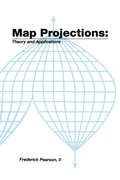
Map ProjectionsTheory and Applications
by II PearsonAbout the Author: Frederick Pearson has extensive experience in teaching map projection at the Air Force Cartography School and Virginia Polytechnic Institute. He developed star charts, satellite trajectory programs, and a celestial navigation device for the Aeronautical Chart and Information Center. He is an expert in orbital analysis of satellites, and control and guidance systems. At McDonnell-Douglas, he worked on the guidance system for the space shuttle.This text develops the plotting equations for the major map projections. The emphasis is on obtaining usable algorithms for computed aided plotting and CRT display. The problem of map projection is stated, and the basic terminology is introduced. The required fundamental mathematics is reviewed, and transformation theory is developed. Theories from differential geometry are particularized for the transformation from a sphere or spheroid as the model of the earth onto a selected plotting surface. The most current parameters to describe the figure of the earth are given. Formulas are included to calculate meridian length, parallel length, geodetic and geocentric latitude, azimuth, and distances on the sphere or spheroid. Equal area, conformal, and conventional projection transformations are derived. All result in direct transformation from geographic to cartesian coordinates. For selected projections, inverse transformations from cartesian to geographic coordinates are given. Since the avoidance of distortion is important, the theory of distortion is explored. Formulas are developed to give a quantitative estimate of linear, area, and angular distortions. Extended examples are given for several mapping problems of interest. Computer applications, and efficient algorithms are presented. This book is an appropriate text for a course in the mathematical aspects of mapping and cartography. Map projections are of interest to workers in many fields. Some of these are mathematicians, engineers, surveyors, geodi
The Map Reader: Theories of Mapping Practice and Cartographic Representation
by Martin Dodge Rob Kitchin Chris PerkinsWINNER OF THE CANTEMIR PRIZE 2012 awarded by the Berendel Foundation The Map Reader brings together, for the first time, classic and hard-to-find articles on mapping. This book provides a wide-ranging and coherent edited compendium of key scholarly writing about the changing nature of cartography over the last half century. The editorial selection of fifty-four theoretical and thought provoking texts demonstrates how cartography works as a powerful representational form and explores how different mapping practices have been conceptualised in particular scholarly contexts. Themes covered include paradigms, politics, people, aesthetics and technology. Original interpretative essays set the literature into intellectual context within these themes. Excerpts are drawn from leading scholars and researchers in a range of cognate fields including: Cartography, Geography, Anthropology, Architecture, Engineering, Computer Science and Graphic Design. The Map Reader provides a new unique single source reference to the essential literature in the cartographic field: more than fifty specially edited excerpts from key, classic articles and monographs critical introductions by experienced experts in the field focused coverage of key mapping practices, techniques and ideas a valuable resource suited to a broad spectrum of researchers and students working in cartography and GIScience, geography, the social sciences, media studies, and visual arts full page colour illustrations of significant maps as provocative visual ‘think-pieces’ fully indexed, clearly structured and accessible ways into a fast changing field of cartographic research
The Map Reader: Theories of Mapping Practice and Cartographic Representation
by The Map ReaderWINNER OF THE CANTEMIR PRIZE 2012 awarded by the Berendel Foundation The Map Reader brings together, for the first time, classic and hard-to-find articles on mapping. This book provides a wide-ranging and coherent edited compendium of key scholarly writing about the changing nature of cartography over the last half century. The editorial selection of fifty-four theoretical and thought provoking texts demonstrates how cartography works as a powerful representational form and explores how different mapping practices have been conceptualised in particular scholarly contexts. Themes covered include paradigms, politics, people, aesthetics and technology. Original interpretative essays set the literature into intellectual context within these themes. Excerpts are drawn from leading scholars and researchers in a range of cognate fields including: Cartography, Geography, Anthropology, Architecture, Engineering, Computer Science and Graphic Design. The Map Reader provides a new unique single source reference to the essential literature in the cartographic field: more than fifty specially edited excerpts from key, classic articles and monographs critical introductions by experienced experts in the field focused coverage of key mapping practices, techniques and ideas a valuable resource suited to a broad spectrum of researchers and students working in cartography and GIScience, geography, the social sciences, media studies, and visual arts full page colour illustrations of significant maps as provocative visual ‘think-pieces’ fully indexed, clearly structured and accessible ways into a fast changing field of cartographic research
The Map That Changed the World: A Tale of Rocks, Ruin and Redemption (Wheeler Large Print Book Ser.)
by Simon WinchesterThe extraordinary tale of the father of modern geology. Hidden behind velvet curtains above a stairway in a house in London's Piccadilly is an enormous and beautiful hand-coloured map - the first geological map of anywhere in the world. Its maker was a farmer's son named William Smith. Born in 1769 his life was beset by troubles: he was imprisoned for debt, turned out of his home, his work was plagiarised, his wife went insane and the scientific establishment shunned him. It was not until 1829, when a Yorkshire aristocrat recognised his genius, that he was returned to London in triumph: The Map That Changed the World is his story.
Maple and Mathematica: A Problem Solving Approach for Mathematics
by Inna K. Shingareva Carlos Lizárraga-CelayaIn the history of mathematics there are many situations in which cal- lations were performed incorrectly for important practical applications. Let us look at some examples, the history of computing the number ? began in Egypt and Babylon about 2000 years BC, since then many mathematicians have calculated ? (e. g. , Archimedes, Ptolemy, Vi` ete, etc. ). The ?rst formula for computing decimal digits of ? was disc- ered by J. Machin (in 1706), who was the ?rst to correctly compute 100 digits of ?. Then many people used his method, e. g. , W. Shanks calculated ? with 707 digits (within 15 years), although due to mistakes only the ?rst 527 were correct. For the next examples, we can mention the history of computing the ?ne-structure constant ? (that was ?rst discovered by A. Sommerfeld), and the mathematical tables, exact - lutions, and formulas, published in many mathematical textbooks, were not veri?ed rigorously [25]. These errors could have a large e?ect on results obtained by engineers. But sometimes, the solution of such problems required such techn- ogy that was not available at that time. In modern mathematics there exist computers that can perform various mathematical operations for which humans are incapable. Therefore the computers can be used to verify the results obtained by humans, to discovery new results, to - provetheresultsthatahumancanobtainwithoutanytechnology. With respectto our example of computing?, we can mention that recently (in 2002) Y. Kanada, Y. Ushiro, H. Kuroda, and M.
Maple and Mathematica: A Problem Solving Approach for Mathematics
by Inna K. Shingareva Carlos Lizárraga-CelayaBy presenting side-by-side comparisons, this handbook enables Mathematica users to quickly learn Maple, and vice versa. The parallel presentation enables students, mathematicians, scientists, and engineers to easily find equivalent functions on each of these algebra programs. The handbook provides core material for incorporating Maple and Mathematica as working tools into many different undergraduate mathematics courses.
Maple® for Environmental Sciences: a Helping Hand
by Bill ScottA presentation of what Maple can do and how it does it in the context of environmental sciences. The text includes introductory tutorials in each chapter combined with extensive marginal comments which are followed by a complete application. These include the contouring of water table data, the physical chemistry of kidney stones, and acid rain. The book also provides a special application to enable students to use "self help" in the case that Maple seem unable to do the simplest things.
Maple griffbereit: Alle Versionen bis Maple V 3
by Nancy Blachman Michael J. MossinghoffIn diesem Buch finden Sie alles, was Sie als Maple-Anwender wissen müssen: Als Neueinsteiger finden Sie eine ausführliche Einführung in die Fähigkeiten des Systems. Als versierter Benutzer können Sie die genaue Bedeutung der verschiedenen Parameter und Optionen für einen bestimmten Befehl nachschauen. Und als "Quereinsteiger" mit Mathematica-Kenntnissen können Sie nachschauen, wie die ihm bekannten Befehle in Maple heißen. Sämtliche Befehle aller Maple-Versionen bis Maple V 3 sind hier sowohl systematisch als auch alphabetisch aufgelistet und erklärt, Bezugs- und Informationsquellen sowie ein Glossar runden das Werk ab, das neben jedem Maple-Rechner liegen sollte.
The Maple Handbook: Maple V Release 3
by Darren RedfernHow to Use This Handbook The Maple Handbook is a complete reference tool for the Maple language, and is written for all Maple users, regardless of their dis cipline or field(s) of interest. All the built-in mathematical, graphic, and system-based commands available in Maple V Release 3 are detailed herein. Please note that The Maple Handbook does not teach about the mathematics behind Maple commands. If you do not know the meaning of such concepts as definite integral, identity matrix, or prime integer, do not expect to learn them here. As well, while the introductory sections to each chapter taken together do provide a basic overview of the capabilities of Maple, it is highly recom mended that you also read a more thorough tutorial such as In troduction to Maple by Andre Heck or First Leaves: A Tutorial Introduction to Maple V. Overall Organization One of the main premises of The Maple Handbook is that most Maple users approach the system to solve a particular problem (or set of problems) in a specific subject area. Therefore, all commands are organized in logical subsets that reflect these different cate gories (e.g., calculus, algebra, data manipulation, etc.) and the com mands within a subset are explained in a similar language, creating a tool that allows you quick and confident access to the information necessary to complete the problem you have brought to the system.
The Maple Handbook: Maple V Release 4
by Darren RedfernAn essential reference tool for all users of the Maple system, providing a complete listing of every command in the Maple language, categorised into logical categories and explained in this context. A short, introductory tutorial starts the Handbook, and each category begins with a brief introduction to the related subject area. It is well referenced, with an alphabetical index of commands, and pointers to appropriate sections of the official Maple documentation. This new approach to reference material enhances that found in Maples on-line help files and provides a much more organised, intuitive resource for all users of the system. The Handbook improves efficiency by supplying users with the information they need - at their fingertips. This new edition covers the Maple V Release 4 symbolic computation language.
Maple in Mathematics Education and Research: Third Maple Conference, MC 2019, Waterloo, Ontario, Canada, October 15–17, 2019, Proceedings (Communications in Computer and Information Science #1125)
by Jürgen Gerhard Ilias KotsireasThis book constitutes the refereed proceedings of the third Maple Conference, MC 2019, held in Waterloo, Ontario, Canada, in October 2019. The 21 revised full papers and 9 short papers were carefully reviewed and selected out of 37 submissions, one invited paper is also presented in the volume. The papers included in this book cover topics in education, algorithms, and applciations of the mathematical software Maple.
Maple V: Learning Guide
by Waterloo Maple IncorporatedMaple V Mathematics Learning Guide is the fully revised introductory documentation for Maple V Release 5. It shows how to use Maple V as a calculator with instant access to hundreds of high-level math routines and as a programming language for more demanding or specialized tasks. Topics include the basic data types and statements in the Maple V language. The book serves as a tutorial introduction and explains the difference between numeric computation and symbolic computation, illustrating how both are used in Maple V Release 5. Extensive "how-to" examples are presented throughout the text to show how common types of calculations can be easily expressed in Maple. Graphics examples are used to illustrate the way in which 2D and 3D graphics can aid in understanding the behaviour of problems.
Maple V für das Ingenieurstudium
by Arnold KrawietzDieses Buch zeigt dem Ingenieurstudenten - und dem in der Praxis tätigen Ingenieur - die für ihn wichtigen Einsatzmöglichkeiten der Computeralgebra und weist auf geeignete mathematische Formulierungen hin. Das geschieht anhand von Fragestellungen aus den Grundlagenfächern (Höhere Mathematik, Technische Mechanik, Physikalisches Praktikum, Elemente des Programmierens), für die der Leser auf diese Weise zugleich ein vertieftes Verständnis gewinnt.
Maple V Programming Guide: for Release 5
by Waterloo Maple IncorporatedMaple V Mathematics Programming Guide is the fully updated language and programming reference for Maple V Release 5. It presents a detailed description of Maple V Release 5 - the latest release of the powerful, interactive computer algebra system used worldwide as a tool for problem-solving in mathematics, the sciences, engineering, and education. This manual describes the use of both numeric and symbolic expressions, the data types available, and the programming language statements in Maple. It shows how the system can be extended or customized through user defined routines and gives complete descriptions of the system's user interface and 2D and 3D graphics capabilities.
Mapped Vector Basis Functions for Electromagnetic Integral Equations (Synthesis Lectures on Computational Electromagnetics)
by Andrew PetersonThe method-of-moments solution of the electric field and magnetic field integral equations (EFIE and MFIE) is extended to conducting objects modeled with curved cells. These techniques are important for electromagnetic scattering, antenna, radar signature, and wireless communication applications. Vector basis functions of the divergence-conforming and curl-conforming types are explained, and specific interpolatory and hierarchical basis functions are reviewed. Procedures for mapping these basis functions from a reference domain to a curved cell, while preserving the desired continuity properties on curved cells, are discussed in detail. For illustration, results are presented for examples that employ divergence-conforming basis functions with the EFIE and curl-conforming basis functions with the MFIE. The intended audience includes electromagnetic engineers with some previous familiarity with numerical techniques.
Mapping: Ways of Representing the World
by Daniel Dorling David FairbairnIllustrates how maps tell us as much about the people and the powers which create them, as about the places they show. Presents historical and contemporary evidence of how the human urge to describe, understand and control the world is presented through the medium of mapping, together with the individual and environmental constraints of the creator of the map.
Mapping an Atlantic World, circa 1500
by Alida C. MetcalfBeginning around 1500, in the decades following Columbus's voyages, the Atlantic Ocean moved from the periphery to the center on European world maps. This brief but highly significant moment in early modern European history marks not only a paradigm shift in how the world was mapped but also the opening of what historians call the Atlantic World. But how did sixteenth-century chartmakers and mapmakers begin to conceptualize—and present to the public—an interconnected Atlantic World that was open and navigable, in comparison to the mysterious ocean that had blocked off the Western hemisphere before Columbus's exploration?In Mapping an Atlantic World, circa 1500, Alida C. Metcalf argues that the earliest surviving maps from this era, which depict trade, colonization, evangelism, and the movement of peoples, reveal powerful and persuasive arguments about the possibility of an interconnected Atlantic World. Blending scholarship from two fields, historical cartography and Atlantic history, Metcalf explains why Renaissance cosmographers first incorporated sailing charts into their maps and began to reject classical models for mapping the world. Combined with the new placement of the Atlantic, the visual imagery on Atlantic maps—which featured decorative compass roses, animals, landscapes, and native peoples—communicated the accessibility of distant places with valuable commodities. Even though individual maps became outdated quickly, Metcalf reveals, new mapmakers copied their imagery, which then repeated on map after map. Individual maps might fall out of date, be lost, discarded, or forgotten, but their geographic and visual design promoted a new way of seeing the world, with an interconnected Atlantic World at its center.Describing the negotiation that took place between a small cadre of explorers and a wider class of cartographers, chartmakers, cosmographers, and artists, Metcalf shows how exploration informed mapmaking and vice versa. Recognizing early modern cartographers as significant agents in the intellectual history of the Atlantic, Mapping an Atlantic World, circa 1500 includes around 50 beautiful and illuminating historical maps.
Mapping and Spatial Modelling for Navigation (NATO ASI Subseries F: #65)
by Louis F. PauThe successful implementation of applications in spatial reasoning requires paying attention to the representation of spatial data. In particular, an integrated and uniform treatment of different spatial features is necessary in order to enable the reasoning to proceed quickly. Currently, the most prevalent features are points, rectangles, lines, regions, surfaces, and volumes. As an example of a reasoning task consider a query of the form "find all cities with population in excess of 5,000 in wheat growing regions within 10 miles of the Mississippi River. " Note that this query is quite complex. It requires- processing a line map (for the river), creating a corridor or buffer (to find the area within 10 miles of the river), a region map (for the wheat), and a point map (for the cities). Spatial reasoning is eased by spatially sorting the data (i. e. , a spatial index). In this paper we show how hierarchical data structures can be used to facilitate this process. They are based on the principle of recursive decomposition (similar to divide and conquer methods). In essence, they are used primarily as devices to sort data of more than one dimension and different spatial types. The term quadtree is often used to describe this class of data structures. In this paper, we focus on recent developments in the use of quadtree methods. We concentrate primarily on region data. For a more extensive treatment of this subject, see [SameS4a, SameSSa, SameSSb, SameSSc, SameSga, SameSgbj.
Mapping Archaeological Landscapes from Space (SpringerBriefs in Archaeology #5)
by Douglas C Comer Michael J. HarrowerMapping Archaeological Landscapes from Space offers a concise overview of air and spaceborne imagery and related geospatial technologies tailored to the needs of archaeologists. Leading experts including scientists involved in NASA’s Space Archaeology program provide technical introductions to five sections: 1) Historic Air and Spaceborne Imagery2) Multispectral and Hyperspectral Imagery3) Synthetic Aperture Radar4) Lidar5) Archaeological Site Detection and ModelingEach of these five sections includes two or more case study applications that have enriched understanding of archaeological landscapes in regions including the Near East, East Asia, Europe, Meso- and North America. Targeted to the needs of researchers and heritage managers as well as graduate and advanced undergraduate students, this volume conveys a basic technological sense of what is currently possible and, it is hoped, will inspire new pioneering applications. Particular attention is paid to the tandem goals of research (understanding) and archaeological heritage management (preserving) the ancient past. The technologies and applications presented can be used to characterize environments, detect archaeological sites, model sites and settlement patterns and, more generally, reveal the dialectic landscape-scale dynamics among ancient peoples and their social and environmental surroundings. In light of contemporary economic development and resultant damage to and destruction of archaeological sites and landscapes, applications of air and spaceborne technologies in archaeology are of wide utility and promoting understanding of them is a particularly appropriate goal at the 40th anniversary of the World Heritage Convention.
Mapping Biological Systems to Network Systems
by Heena RathoreThe book presents the challenges inherent in the paradigm shift of network systems from static to highly dynamic distributed systems – it proposes solutions that the symbiotic nature of biological systems can provide into altering networking systems to adapt to these changes. The author discuss how biological systems – which have the inherent capabilities of evolving, self-organizing, self-repairing and flourishing with time – are inspiring researchers to take opportunities from the biology domain and map them with the problems faced in network domain. The book revolves around the central idea of bio-inspired systems -- it begins by exploring why biology and computer network research are such a natural match. This is followed by presenting a broad overview of biologically inspired research in network systems -- it is classified by the biological field that inspired each topic and by the area of networking in which that topic lies. Each case elucidates how biological concepts have been most successfully applied in various domains. Nevertheless, it also presents a case study discussing the security aspects of wireless sensor networks and how biological solution stand out in comparison to optimized solutions. Furthermore, it also discusses novel biological solutions for solving problems in diverse engineering domains such as mechanical, electrical, civil, aerospace, energy and agriculture. The readers will not only get proper understanding of the bio inspired systems but also better insight for developing novel bio inspired solutions.
Mapping The Chinese And Islamic Worlds: Cross-cultural Exchange In Pre-modern Asia (pdf)
by Hyunhee ParkLong before Vasco da Gama rounded the Cape of Good Hope en route to India, the peoples of Africa, the Middle East, and Asia engaged in vigorous cross-cultural exchanges across the Indian Ocean. This book focuses on the years 700 to 1500, a period when powerful dynasties governed both regions, to document the relationship between the Islamic and Chinese worlds before the arrival of the Europeans. Through a close analysis of the maps, geographic accounts, and travelogues compiled by both Chinese and Islamic writers, the book traces the development of major contacts between people in China and the Islamic world and explores their interactions on matters as varied as diplomacy, commerce, mutual understanding, world geography, navigation, shipbuilding, and scientific exploration. When the Mongols ruled both China and Iran in the thirteenth and fourteenth centuries, their geographic understanding of each other's society increased markedly. This rich, engaging, and pioneering study offers glimpses into the worlds of Asian geographers and mapmakers, whose accumulated wisdom underpinned the celebrated voyages of European explorers like Vasco da Gama.
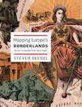
Mapping Europe's Borderlands: Russian Cartography in the Age of Empire
by Steven SeegelThe simplest purpose of a map is a rational one: to educate, to solve a problem, to point someone in the right direction. Maps shape and communicate information, for the sake of improved orientation. But maps exist for states as well as individuals, and they need to be interpreted as expressions of power and knowledge, as Steven Seegel makes clear in his impressive and important new book. Mapping Europe’s Borderlands takes the familiar problems of state and nation building in eastern Europe and presents them through an entirely new prism, that of cartography and cartographers. Drawing from sources in eleven languages, including military, historical-pedagogical, and ethnographic maps, as well as geographic texts and related cartographic literature, Seegel explores the role of maps and mapmakers in the East Central European borderlands from the Enlightenment to the Treaty of Versailles. For example, Seegel explains how Russia used cartography in the aftermath of the Napoleonic Wars and, later, formed its geography society as a cover for gathering intelligence. He also explains the importance of maps to the formation of identities and institutions in Poland, Ukraine, and Lithuania, as well as in Russia. Seegel concludes with a consideration of the impact of cartographers’ regional and socioeconomic backgrounds, educations, families, career options, and available language choices.