- Table View
- List View
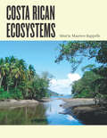
Costa Rican Ecosystems
by Rodrigo Gámez LoboIn the more than thirty years since the publication of Daniel H. Janzen’s classic Costa Rican Natural History, research in this small but astonishingly biodiverse, well-preserved, and well-studied Latin American nation has evolved from a species-level approach to the study of entire ecosystems. And from the lowland dry forests of Guanacaste to the montane cloud forests of Monteverde, from the seasonal forests of the Central Valley to the coastal species assemblages of Tortuguero, Costa Rica has proven to be as richly diverse in ecosystems as it is in species. In Costa Rican Ecosystems, Maarten Kappelle brings together a collection of the world’s foremost experts on Costa Rican ecology—outstanding scientists such as Daniel H. Janzen, Jorge Cortés, Jorge A. Jiménez, Sally P. Horn, Robert O. Lawton, Quírico Jiménez M., Carlos Manuel Rodríguez, Catherine M. Pringle, and Eduardo Carrillo J., among others—to offer the first comprehensive account of the diversity, structure, function, uses, and conservation of Costa Rica’s ecosystems. Featuring a foreword and introductory remarks by two renowned leaders in biodiversity science and ecological conservation, Thomas E. Lovejoy and Rodrigo Gámez Lobo, in addition to chapters highlighting the geology, soils, and climate of Costa Rica, as well as the ecosystems of its terrestrial, freshwater, and marine habitats, and including previously unpublished information on Isla del Coco, this beautiful color-illustrated book will be an essential reference for academic scientists, students, natural history guides, conservationists, educators, park guards, and visitors alike.
The Economics of Marine Resources and Conservation Policy: The Pacific Halibut Case Study with Commentary
by James Andrew Crutchfield Arnold ZellnerHow can we manage a so-called "renewable" natural resource such as a fishery when we don't know how renewable it really is? James A. Crutchfield and Arnold Zellner developed a dynamic and highly successful economic approach to this problem, drawing on extensive data from the Pacific halibut industry. Although the U.S. Department of the Interior published a report about their findings in 1962, it had very limited distribution and is now long out of print. This book presents a complete reprint of Crutchfield and Zellner's pioneering study, together with a new introduction by the authors and four new papers by other scholars. These new studies cover the history of the Pacific halibut industry as well as the general and specific contributions of the original work—such as price-oriented conservation policy—to the fields of resource economics and management. The resulting volume integrates theory and practice in a clear, well-contextualized case study that will be important not just for environmental and resource economists, but also for leaders of industries dependent on any natural resource.
The Economics of Marine Resources and Conservation Policy: The Pacific Halibut Case Study with Commentary
by James A. Crutchfield Arnold ZellnerHow can we manage a so-called "renewable" natural resource such as a fishery when we don't know how renewable it really is? James A. Crutchfield and Arnold Zellner developed a dynamic and highly successful economic approach to this problem, drawing on extensive data from the Pacific halibut industry. Although the U.S. Department of the Interior published a report about their findings in 1962, it had very limited distribution and is now long out of print. This book presents a complete reprint of Crutchfield and Zellner's pioneering study, together with a new introduction by the authors and four new papers by other scholars. These new studies cover the history of the Pacific halibut industry as well as the general and specific contributions of the original work—such as price-oriented conservation policy—to the fields of resource economics and management. The resulting volume integrates theory and practice in a clear, well-contextualized case study that will be important not just for environmental and resource economists, but also for leaders of industries dependent on any natural resource.
The Trilobite Book: A Visual Journey
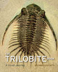
by Riccardo Levi-SettiDistant relatives of modern lobsters, horseshoe crabs, and spiders, trilobites swam the planet’s prehistoric seas for 300 million years, from the Lower Cambrian to the end of the Permian eras—and they did so very capably. Trilobite fossils have been unearthed on every continent, with more than 20,000 species identified by science. One of the most arresting animals of our pre-dinosaur world, trilobites are also favorites among the fossil collectors of today, their crystalline eyes often the catalyst for a lifetime of paleontological devotion. And there is no collector more devoted—or more venerated—than Riccardo Levi-Setti. With The Trilobite Book, a much anticipated follow-up to his classic Trilobites, Levi-Setti brings us a glorious and revealing guide to these surreal arthropods of ancient Earth. Featuring specimens from Bohemia to Newfoundland, California to the Tucson Gem and Mineral Show, and Wales to the Anti-Atlas Mountains of Morocco, Levi-Setti’s magnificent book reanimates these “butterflies of the seas” in 235 astonishing full-color photographs. All original, Levi-Setti’s images serve as the jumping-off point for tales of his global quests in search of these highly sought-after fossils; for discussions of their mineralogical origins, as revealed by their color; and for unraveling the role of the now-extinct trilobites in our planetary history. Sure to enthrall paleontologists with its scientific insights and amateur enthusiasts with its beautiful and informative images, The Trilobite Book combines the best of science, technology, aesthetics, and personal adventure. It will inspire new collectors for eras to come.
The Trilobite Book: A Visual Journey
by Riccardo Levi-SettiDistant relatives of modern lobsters, horseshoe crabs, and spiders, trilobites swam the planet’s prehistoric seas for 300 million years, from the Lower Cambrian to the end of the Permian eras—and they did so very capably. Trilobite fossils have been unearthed on every continent, with more than 20,000 species identified by science. One of the most arresting animals of our pre-dinosaur world, trilobites are also favorites among the fossil collectors of today, their crystalline eyes often the catalyst for a lifetime of paleontological devotion. And there is no collector more devoted—or more venerated—than Riccardo Levi-Setti. With The Trilobite Book, a much anticipated follow-up to his classic Trilobites, Levi-Setti brings us a glorious and revealing guide to these surreal arthropods of ancient Earth. Featuring specimens from Bohemia to Newfoundland, California to the Tucson Gem and Mineral Show, and Wales to the Anti-Atlas Mountains of Morocco, Levi-Setti’s magnificent book reanimates these “butterflies of the seas” in 235 astonishing full-color photographs. All original, Levi-Setti’s images serve as the jumping-off point for tales of his global quests in search of these highly sought-after fossils; for discussions of their mineralogical origins, as revealed by their color; and for unraveling the role of the now-extinct trilobites in our planetary history. Sure to enthrall paleontologists with its scientific insights and amateur enthusiasts with its beautiful and informative images, The Trilobite Book combines the best of science, technology, aesthetics, and personal adventure. It will inspire new collectors for eras to come.
Foundations of Ecology II: Classic Papers with Commentaries
The classic papers that laid the foundations of modern ecology alongside commentaries by noted ecologists. The period of 1970 to 1995 was a time of tremendous change in all areas of ecology—from an increased rigor for experimental design and analysis to the reevaluation of paradigms, new models for understanding, and theoretical advances. Edited by ecologists Thomas E. Miller and Joseph Travis, Foundations of Ecology II includes facsimiles of forty-six papers from this period alongside expert commentaries that discuss a total of fifty-three key studies, addressing topics of diversity, predation, complexity, competition, coexistence, extinction, productivity, resources, distribution, abundance, and conservation. The result is more than a catalog of historic firsts; this book offers diverse perspectives on the foundational papers that led to today’s ecological work. Like this book’s 1991 predecessor, Foundations of Ecology edited by Leslie A. Real and James H. Brown, Foundations of Ecology II promises to be the essential primer for graduate students and practicing ecologists for decades to come.
Medieval Islamic Maps: An Exploration
by Karen C. PintoHundreds of exceptional cartographic images are scattered throughout medieval and early modern Arabic, Persian, and Turkish manuscript collections. The plethora of copies created around the Islamic world over the course of eight centuries testifies to the enduring importance of these medieval visions for the Muslim cartographic imagination. With Medieval Islamic Maps, historian Karen C. Pinto brings us the first in-depth exploration of medieval Islamic cartography from the mid-tenth to the nineteenth century. Pinto focuses on the distinct tradition of maps known collectively as the Book of Roads and Kingdoms (Kitab al-Masalik wa al-Mamalik, or KMMS), examining them from three distinct angles—iconography, context, and patronage. She untangles the history of the KMMS maps, traces their inception and evolution, and analyzes them to reveal the identities of their creators, painters, and patrons, as well as the vivid realities of the social and physical world they depicted. In doing so, Pinto develops innovative techniques for approaching the visual record of Islamic history, explores how medieval Muslims perceived themselves and their world, and brings Middle Eastern maps into the forefront of the study of the history of cartography.
Rome Measured and Imagined: Early Modern Maps of the Eternal City
by Jessica MaierAt the turn of the fifteenth century, Rome was in the midst of a dramatic transformation from what the fourteenth-century poet Petrarch had termed a “crumbling city” populated by “broken ruins” into a prosperous Christian capital. Scholars, artists, architects, and engineers fascinated by Rome were spurred to develop new graphic modes for depicting the city—and the genre known as the city portrait exploded. In Rome Measured and Imagined, Jessica Maier explores the history of this genre—which merged the accuracy of scientific endeavor with the imaginative aspects of art—during the rise of Renaissance print culture. Through an exploration of works dating from the fifteenth to the eighteenth centuries, her book interweaves the story of the city portrait with that of Rome itself. Highly interdisciplinary and beautifully illustrated with nearly one hundred city portraits, Rome Measured and Imagined advances the scholarship on Renaissance Rome and print culture in fascinating ways.
Globes: 400 Years of Exploration, Navigation, and Power
by Sylvia SumiraThe concept of the earth as a sphere has been around for centuries, emerging around the time of Pythagoras in the sixth century BC, and eventually becoming dominant as other thinkers of the ancient world, including Plato and Aristotle, accepted the idea. The first record of an actual globe being made is found in verse, written by the poet Aratus of Soli, who describes a celestial sphere of the stars by Greek astronomer Eudoxus of Cnidus (ca. 408–355 BC). The oldest surviving globe—a celestial globe held up by Atlas’s shoulders—dates back to 150 AD, but in the West, globes were not made again for about a thousand years. It was not until the fifteenth century that terrestrial globes gained importance, culminating when German geographer Martin Behaim created what is thought to be the oldest surviving terrestrial globe. In Globes: 400 Years of Exploration, Navigation, and Power, Sylvia Sumira, beginning with Behaim’s globe, offers a authoritative and striking illustrated history of the subsequent four hundred years of globe making. Showcasing the impressive collection of globes held by the British Library, Sumira traces the inception and progression of globes during the period in which they were most widely used—from the late fifteenth century to the late nineteenth century—shedding light on their purpose, function, influence, and manufacture, as well as the cartographers, printers, and instrument makers who created them. She takes readers on a chronological journey around the world to examine a wide variety of globes, from those of the Renaissance that demonstrated a renewed interest in classical thinkers; to those of James Wilson, the first successful commercial globe maker in America; to those mass-produced in Boston and New York beginning in the 1800s. Along the way, Sumira not only details the historical significance of each globe, but also pays special attention to their materials and methods of manufacture and how these evolved over the centuries. A stunning and accessible guide to one of the great tools of human exploration, Globes will appeal to historians, collectors, and anyone who has ever examined this classroom accessory and wondered when, why, and how they came to be made.
The Mysteries of the Marco Polo Maps
by Benjamin B. OlshinIn the thirteenth century, Italian merchant and explorer Marco Polo traveled from Venice to the far reaches of Asia, a journey he chronicled in a narrative titled Il Milione, later known as The Travels of Marco Polo. While Polo’s writings would go on to inspire the likes of Christopher Columbus, scholars have long debated their veracity. Some have argued that Polo never even reached China, while others believe that he came as far as the Americas. Now, there’s new evidence for this historical puzzle: a very curious collection of fourteen little-known maps and related documents said to have belonged to the family of Marco Polo himself. In The Mysteries of the Marco Polo Maps, historian of cartography Benjamin B. Olshin offers the first credible book-length analysis of these artifacts, charting their course from obscure origins in the private collection of Italian-American immigrant Marcian Rossi in the 1930s; to investigations of their authenticity by the Library of Congress, J. Edgar Hoover, and the FBI; to the work of the late cartographic scholar Leo Bagrow; to Olshin’s own efforts to track down and study the Rossi maps, all but one of which are in the possession of Rossi’s great-grandson Jeffrey Pendergraft. Are the maps forgeries, facsimiles, or modernized copies? Did Marco Polo’s daughters—whose names appear on several of the artifacts—preserve in them geographic information about Asia first recorded by their father? Or did they inherit maps created by him? Did Marco Polo entrust the maps to Admiral Ruggero Sanseverino, who has links to Rossi’s family line? Or, if the maps have no connection to Marco Polo, who made them, when, and why? Regardless of the maps’ provenance, Olshin’s tale—stretching from the remote reaches of the northern Pacific to early Chinese legends—takes readers on a journey confounding yet fascinating, offering insights into Italian history, the age of exploration, and the wonders of cartography.
The History of Cartography, Volume 6: Cartography in the Twentieth Century (The History of Cartography #Vol. 6)
by Mark MonmonierFor more than thirty years, the History of Cartography Project has charted the course for scholarship on cartography, bringing together research from a variety of disciplines on the creation, dissemination, and use of maps. Volume 6, Cartography in the Twentieth Century, continues this tradition with a groundbreaking survey of the century just ended and a new full-color, encyclopedic format. The twentieth century is a pivotal period in map history. The transition from paper to digital formats led to previously unimaginable dynamic and interactive maps. Geographic information systems radically altered cartographic institutions and reduced the skill required to create maps. Satellite positioning and mobile communications revolutionized wayfinding. Mapping evolved as an important tool for coping with complexity, organizing knowledge, and influencing public opinion in all parts of the globe and at all levels of society. Volume 6 covers these changes comprehensively, while thoroughly demonstrating the far-reaching effects of maps on science, technology, and society—and vice versa. The lavishly produced volume includes more than five hundred articles accompanied by more than a thousand images. Hundreds of expert contributors provide both original research, often based on their own participation in the developments they describe, and interpretations of larger trends in cartography. Designed for use by both scholars and the general public, this definitive volume is a reference work of first resort for all who study and love maps.
The Icon Curtain: The Cold War's Quiet Border
by Yuliya KomskaThe Iron Curtain did not exist—at least not as we usually imagine it. Rather than a stark, unbroken line dividing East and West in Cold War Europe, the Iron Curtain was instead made up of distinct landscapes, many in the grip of divergent historical and cultural forces for decades, if not centuries. This book traces a genealogy of one such landscape—the woods between Czechoslovakia and West Germany—to debunk our misconceptions about the iconic partition. Yuliya Komska transports readers to the western edge of the Bohemian Forest, one of Europe’s oldest borderlands, where in the 1950s civilians set out to shape the so-called prayer wall. A chain of new and repurposed pilgrimage sites, lookout towers, and monuments, the prayer wall placed two long-standing German obsessions, forest and border, at the heart of the century’s most protracted conflict. Komska illustrates how civilians used the prayer wall to engage with and contribute to the new political and religious landscape. In the process, she relates West Germany’s quiet sylvan periphery to the tragic pitch prevalent along the Iron Curtain’s better-known segments. Steeped in archival research and rooted in nuanced interpretations of wide-ranging cultural artifacts, from vandalized religious images and tourist snapshots to poems and travelogues, The Icon Curtain pushes disciplinary boundaries and opens new perspectives on the study of borders and the Cold War alike.