- Table View
- List View
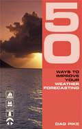
50 Ways to Improve Your Weather Forecasting (50 Ways to Improve Your...)
by Dag PikeThis is a book about practical weather forecasting, and it starts where most other books finish. Weather forecasts give you a lot of information about the weather to come but they often leave out a lot of the detail, and the timing of changes can also be vague. In this book, Dag Pike shows how to translate the basics into practical weather forecasts so that you can work out what it will be like in your area and along your proposed route. Sailors will be able to make better use of the available wind and avoid difficult areas, whilst powerboat drivers more interested in the sea conditions will be able to find the smoothest waters for a better ride. With the help of this book, readers will pick up expert tips such asPredicting the weather at sea from scanty weather forecasts Knowing what conditions to expect when near cliffs, river estuaries and valleys Understanding how the wind affects tides50 Ways to Improve Your Weather Forecasting distils Dag Pike's experience gained from over 50 years of driving a whole range of craft from high-speed powerboats and lifeboats to ships and sailing boats. Written by one of the most experienced seamen in the world, it is your passport to practical weather forecasting techniques that will get you safely to your destination whether in fine weather or foul.
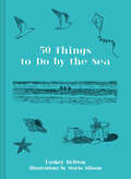
50 Things to Do by the Sea
by Easkey BrittonA beautifully presented, practical gift guide for all surf seekers. Explained with fascinating, easy-to-understand commentary from surfer and scientist Easkey Britton, this guide helps you soak up maximum vitamin sea.
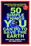
50 Simple Things You Can Do to Save the Earth: Completely New and Updated for the 21st Century
by John JavnaTogether, We Can Make a DifferenceToday's environmental problems may seem too overwhelming for one person to tackle . . . but you don't have to do it alone. Now you have partners--50 of them.50 Simple Things You Can Do to Save the Earth, the revolutionary 1990 bestseller, is back in a completely revised, updated edition . . . and it's just as innovative and groundbreaking as the original. The authors have teamed up with 50 of America's top environmental groups, including The Natural Resources Defense Council, the National Wildlife Federation, and Rainforest Action Network. Each group has chosen one issue and provided a simple, step-by-step program that will empower you and your family to become citizen activists in the fight to save the Earth.It's easy to get started. Just pick one!Fight global warming "one city at a time" with the Sierra Club's Cool Cities Campaign Roll up your sleeves and save an endangered species with the Wilderness Society Protect coral reefs and create a marine reserve with Seacology Get your congregation excited about protecting God's creations with Interfaith Power and Light Invite songbirds into your neighborhood with the National Audubon SocietyAll it takes is a little effort. When we work together, we can work miracles! Get started now!
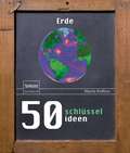
50 Schlüsselideen Erde
by Martin RedfernEine Entdeckungsreise in die Geschichte und Entwicklung unseres Planeten und des LebensUnser Heimatplanet ist der mit Abstand außergewöhnlichste Ort im uns bekannten Universum. Er wiegt 6000 Trillionen Tonnen und saust mit 107.826 km/h durch das All; ein Punkt am Äquator rast mit einer Geschwindigkeit von 1609 km/h um die Erdachse herum. Auf der Erde gibt es nicht nur eine riesige Bandbreite von einzigartigen geologischen, strukturellen und klimatischen Erscheinungen, sie ist möglicherweise auch der einzige Ort im Kosmos, der jenes höchst bemerkenswerte und geheimnisvolle Phänomen beheimatet: das Leben. Dieses Buch ist eine umfassende und spannende Einführung in die inzwischen 4,5 Milliarden Jahre dauernde Geschichte unserer Welt.Die Story beginnt in der fernen Vergangenheit, als die Erde und das Sonnensystem sich aus herumfliegenden Trümmern eines explodierten Sterns bildeten. Der preisgekrönte Autor Martin Redfern nimmt uns mit auf eine großartige geführte Tour zu unserem Planeten. Er erklärt uns unter anderem,wie die Atmosphäre und die Ozeane interagieren und so die Dynamik unseres Klimas hervorbringenwie Hitze aus dem Inneren der Erde Prozesse an der Oberfläche antreibt, darunter die Plattentektonik, durch die Gebirge, Erdbeben und Verwerfungszonen entstehen wie Sedimente entstehen und was sie uns über das Alter unseres Planeten erzählen können und wie über Milliarden von Jahren in einem ewigen Kreislauf von Evolution und Aussterben Lebensformen aufblühten und wieder verschwanden.Was ist die Triebkraft von vulkanischen Eruptionen? Wie entstehen aus sanften Brisen zerstörerische Stürme? Wodurch wurden die Dinosaurier ausgelöscht? Und wie wird unsere Spezies mit dem Klimawandel und schwindenden natürlichen Ressourcen zurecht kommen? Um diese und zahlreiche andere Fragen zu beantworten, zieht der Autor die neuesten wissenschaftlichen Ergebnisse heran. Sein Buch ist die ideale Einführung für jeden, der erpicht darauf ist, die Wunder unseres Planeten zu erkunden.
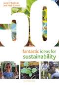
50 Fantastic Ideas for Sustainability (50 Fantastic Ideas)
by June O'Sullivan Nick CorlettTeach children to reduce, reuse, recycle, repair and be respectful with 50 fun activities for encouraging environmental sustainability. From making planters and bird feeders to creating natural paints or even bringing broken crayons back to life, these original ideas encourage children and practitioners to see the potential for creativity and fun using and reusing everyday, easy-to-source items, some of which might have otherwise gone to waste.Enhance children's creativity, cognitive development and motor skills through indoor and outdoor activities that are enjoyable, educational and environmentally friendly. 50 Fantastic Ideas for Sustainability encourages children to be considerate and responsible, paving the way for a positive lifelong attitude towards the environment. June O'Sullivan and Nick Corlett bring their expertise from the London Early Years Foundation to this must-have collection of inspiring, sustainability-focused activities.With over 40 books in the 50 Fantastic Ideas series, there's something for everyone – whether you're a practitioner looking for new ideas or you want to try out a popular well-loved activity with a new twist. Each book offers a wide range of fun and creative activities to carry out with children aged 0–5 years, with lists of resources, step-by-step instructions and information about the benefits for children.
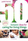
50 Fantastic Ideas for Caring for Living Things (50 Fantastic Ideas)
by Judith HarriesA brilliant collection of activities for teaching children to care for animals and plants.The ideas in this book will enable children to experience the delights of watching animals and plants grow, sharing and caring for pets, observing a variety of life-cycles, surveying different minibeasts and finding out how to help vulnerable wild animals like hedgehogs. Linked to the Understanding the World section of the EYFS framework, this book includes ideas for games, creative activities, role play and hands-on experiences with animals and plants to build children's empathy and encourage respect for living things, both in their own environments and further afield.With over 40 books in the 50 Fantastic Ideas series there's something for everyone – whether you're a practitioner looking for new ideas or you want to try out a popular well-loved activity with a new twist. Each book offers a wide range of fun and creative activities to carry out with children aged 0–5 years, with lists of resources, step-by-step instructions and information about the benefits for children.
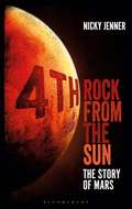
4th Rock from the Sun: The Story of Mars
by Nicky JennerMars is ingrained in our culture, from David Bowie's extra-terrestrial spiders to H.G. Wells's The War of the Worlds. The red planet has inspired hundreds of scientists, authors and filmmakers - but why? What is it about this particular planet that makes it so intriguing?Ancient mythologies defined Mars as a violent harbinger of war, and astrologers found meaning in the planet's dance through the sky. Stargazers puzzled over Mars's unfamiliar properties; some claimed to see canals criss-crossing its surface, while images from early spacecraft showed startling faced and pyramids carved out of rusty rock. Did Martians exist? If so, were they intelligent, civilised beings?We now have a better understanding of Mars: its red hue, small moons, atmosphere (or lack of it), and mysterious past. Robots have trundled across the planet's surface, beaming back astonishing views of the alien landscape and seeking clues on how it has evolved. While little green Martians are now firmly the preserve of literature, evidence is growing that the now arid, frozen planet was once warmer, wetter, and possibly thronging with microbial life. Soon, we may set food on the planet. What challenges are involved, and how are we preparing for them? Is there a future for humanity on Mars?In 4th Rock from the Sun, Nicky Jenner reviews Mars in its entirety, exploring its nature, attributes, potential as a human colony and impact on 3rd Rock-culture - everything you need to know about the Red Planet.
49.–50. Jahresbericht des Sonnblick-Vereines für die Jahre 1951–1952 (Jahresberichte des Sonnblick-Vereines #1951/52)
by Ferdinand Steinhauser
40 Years of China's War on Poverty
by Xinkai Zhu Chao PengChina's anti-poverty campaign has liberated hundreds of millions of citizens from absolute poverty, offering a compelling model for other developing countries around the world. This book demonstrates the path of China’s poverty alleviation and explores the approach and the theory underlying the country’s experience. The authors elucidate four important stages of poverty alleviation in China. They further investigate how the administration has balanced economic growth, regional development and the protection of ecosystem and cultural and heritage sites during China's remarkable transformation. As China’s development experience have extended the theory of international poverty alleviation, this book should provide valuable insights and offer enlightenment to global scholars, NGOs and governments of other developing countries.
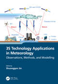
3S Technology Applications in Meteorology: Observations, Methods, and Modelling
by Shuanggen JinSpatial information technology and its integration, such as remote sensing, geographic information systems (GIS), and global navigation satellite systems (GNSS), known as 3S technology, have been extensively utilized in managing and monitoring natural disasters. This book illustrates the 3S integrated applications in the field of meteorology and promotes the role of 3S in developing precise and intelligent meteorology. It presents the principles of 3S technology and the methods for monitoring different meteorological disasters and hazards as well as their application progress. The case studies from the United States, Japan, China, and Europe were conducted to help all countries understand the 3S technology functions in handling and monitoring severe meteorological hazards. FEATURES Presents integral observations from GNSS, GIS, and remote sensing in estimating and understanding meteorological changes Explains how to monitor and retrieve atmospheric parameter changes using GNSS and remote sensing Shows three-dimensional modelling and evaluations of meteorological variation processing based on GIS Helps meteorologists develop and use space-air-ground integrated observations for meteorological applications Illustrates the practices in monitoring meteorological hazards using space information techniques and case studies This book is intended for academics, researchers, and postgraduate students who specialize in geomatics, atmospheric science, and meteorology, as well as scientists who work in remote sensing and meteorology, and professionals who deal with meteorological hazards.
3D Recording and Interpretation for Maritime Archaeology (Coastal Research Library #31)
by Wendy Van Duivenvoorde Trevor Winton Jonathan Benjamin John K. McCarthyThis open access peer-reviewed volume was inspired by the UNESCO UNITWIN Network for Underwater Archaeology International Workshop held at Flinders University, Adelaide, Australia in November 2016. Content is based on, but not limited to, the work presented at the workshop which was dedicated to 3D recording and interpretation for maritime archaeology. The volume consists of contributions from leading international experts as well as up-and-coming early career researchers from around the globe. The content of the book includes recording and analysis of maritime archaeology through emerging technologies, including both practical and theoretical contributions. Topics include photogrammetric recording, laser scanning, marine geophysical 3D survey techniques, virtual reality, 3D modelling and reconstruction, data integration and Geographic Information Systems. The principal incentive for this publication is the ongoing rapid shift in the methodologies of maritime archaeology within recent years and a marked increase in the use of 3D and digital approaches. This convergence of digital technologies such as underwater photography and photogrammetry, 3D sonar, 3D virtual reality, and 3D printing has highlighted a pressing need for these new methodologies to be considered together, both in terms of defining the state-of-the-art and for consideration of future directions. As a scholarly publication, the audience for the book includes students and researchers, as well as professionals working in various aspects of archaeology, heritage management, education, museums, and public policy. It will be of special interest to those working in the field of coastal cultural resource management and underwater archaeology but will also be of broader interest to anyone interested in archaeology and to those in other disciplines who are now engaging with 3D recording and visualization.
3D Radiative Transfer in Cloudy Atmospheres (Physics of Earth and Space Environments)
by Alexander Marshak Anthony DavisDevelopments in three-dimensional cloud radiation over the past few decades are assessed and distilled into this contributed volume. Chapters are authored by subject-matter experts who address a broad audience of graduate students, researchers, and anyone interested in cloud-radiation processes in the solar and infrared spectral regions. After two introductory chapters and a section on the fundamental physics and computational techniques, the volume extensively treats two main application areas: the impact of clouds on the Earth's radiation budget, which is an essential aspect of climate modeling; and remote observation of clouds, especially with the advanced sensors on current and future satellite missions.
3D Printing for Product Designers: Innovative Strategies Using Additive Manufacturing
by Jennifer Loy James Novak Olaf Diegel3D Printing for Product Designers closes the gap between the rhetoric of 3D printing in manufacturing and the reality for product designers. It provides practical strategies to support the adoption and integration of 3D printing into professional practice. 3D printing has evolved over the last decade into a practical proposition for manufacturing, opening up innovative opportunities for product designers. From its foundations in rapid prototyping, additive manufacturing has developed into a range of technologies suitable for end-use products. This book shows you how to evaluate and sensitively understand people, process, and products and demonstrates how solutions for working with additive manufacturing can be developed in context. It includes a practical, step-by-step plan for product designers and CEOs aimed at supporting the successful implementation of 3D printing by stakeholders at all levels of a manufacturing facility, tailored to their stage of technology integration and business readiness. It features a wide range of real-world examples of practice illustrated in full colour, across industries such as healthcare, construction, and film, aligning with the strategic approach outlined in the book. The book can be followed chronologically to guide you to transform your process for a company, to meet the unique needs of a specific client, or to be used as a starting point for the product design entrepreneur. Written by experienced industry professionals and academics, this is a fundamental reference for product designers, industrial designers, design engineers, CEOs, consultants, and makers.
3D Imaging of the Environment: Mapping and Monitoring
by John MeneelyThis is a comprehensive, overarching, interdisciplinary book and a valuable contribution to a unified view of visualisation, imaging, and mapping. It covers a variety of modern techniques, across an array of spatial scales, with examples of how to map, monitor, and visualise the world in which we live. The authors give detailed explanations of the techniques used to map and monitor the built and natural environment and how that data, collected from a wide range of scales and cost options, is translated into an image or visual experience. It is written in a way that successfully reaches technical, professional, and academic readers alike, particularly geographers, architects, geologists, and planners. FEATURES Includes in-depth discussion on 3D image processing and modeling Focuses on the 3D application of remote sensing, including LiDAR and digital photography acquired by UAS and terrestrial techniques Introduces a broad range of data collection techniques and visualisation methods Includes contributions from outstanding experts and interdisciplinary teams involved in earth sciences Presents an open access chapter about the EU-funded CHERISH Project, detailing the development of a toolkit for the 3D documentation and analysis of the combined coastline shared between Ireland and Wales Intended for those with a background in the technology involved with imaging and mapping, the contributions shared in this book introduce readers to new and emerging 3D imaging tools and programs.
3D Imaging of the Environment: Mapping and Monitoring
This is a comprehensive, overarching, interdisciplinary book and a valuable contribution to a unified view of visualisation, imaging, and mapping. It covers a variety of modern techniques, across an array of spatial scales, with examples of how to map, monitor, and visualise the world in which we live. The authors give detailed explanations of the techniques used to map and monitor the built and natural environment and how that data, collected from a wide range of scales and cost options, is translated into an image or visual experience. It is written in a way that successfully reaches technical, professional, and academic readers alike, particularly geographers, architects, geologists, and planners. FEATURES Includes in-depth discussion on 3D image processing and modeling Focuses on the 3D application of remote sensing, including LiDAR and digital photography acquired by UAS and terrestrial techniques Introduces a broad range of data collection techniques and visualisation methods Includes contributions from outstanding experts and interdisciplinary teams involved in earth sciences Presents an open access chapter about the EU-funded CHERISH Project, detailing the development of a toolkit for the 3D documentation and analysis of the combined coastline shared between Ireland and Wales Intended for those with a background in the technology involved with imaging and mapping, the contributions shared in this book introduce readers to new and emerging 3D imaging tools and programs.
3D-Groundwater Modeling with PMWIN: A Simulation System for Modeling Groundwater Flow and Transport Processes
by Wen-Hsing ChiangThis book offer a complete simulation system for modeling groundwater flow and transport processes. The companion full-version software (PMWIN) comes with a professional graphical user-interface, supported models and programs and several other useful modeling tools. Tools include a Presentation Tool, a Result Extractor, a Field Interpolator, a Field Generator, a Water Budget Calculator and a Graphic Viewer. Book targeted at novice and experienced groundwater modelers.
3D-Groundwater Modeling with PMWIN: A Simulation System for Modeling Groundwater Flow and Pollution
by Wen-Hsing Chiang Wolfgang KinzelbachThis book and CD-ROM offer a complete simulation system for modeling groundwater flow and transport processes. The companion full-version software (PMWIN) comes with a professional graphical user-interface, supported models and programs and several other useful modeling tools. Tools include a Presentation Tool, a Result Extractor, a Field Interpolator, a Field Generator, a Water Budget Calculator and a Graphic Viewer. Book and CD-ROM are targeted at novice and experienced groundwater modelers.
3D Geoscience Modeling: Computer Techniques for Geological Characterization
by Simon HouldingThis book is a result of a career spent developing and applying computer techniques for the geosciences. The need for a geoscience modeling reference became apparent during participation in several workshops and conferences on the subject in the last three years. For organizing these, and for the lively discussions that ensued and inevitably contributed to the contents, I thank Keith Turner, Brian Kelk, George Pflug and Johnathan Raper. The total number of colleagues who contributed in various ways over the preceding years to the concepts and techniques presented is beyond count. The book is dedicated to all of them. Compilation of the book would have been impossible without assistance from a number of colleagues who contributed directly. In particular, Ed Rychkun, Joe Ringwald, Dave Elliott, Tom Fisher and Richard Saccany reviewed parts of the text and contributed valuable comment. Mohan Srivastava reviewed and contributed to some of the geostatistical presentations. Mark Stoakes, Peter Dettlaff and Simon Wigzell assisted with computer processing of the many application examples. Anar Khanji and Randal Crombe assisted in preparation of the text and computer images. Klaus Lamers assisted with printing. The US Geological Survey, the British Columbia Ministry of Environment, Dave Elliott and others provided data for the application examples. My sincere thanks to all of them.
3D Geoinformation Science: The Selected Papers of the 3D GeoInfo 2014 (Lecture Notes in Geoinformation and Cartography #94)
by Martin Breunig Mulhim Al-Doori Edgar Butwilowski Paul V. Kuper Joachim Benner Karl Heinz HaefeleNowadays 3D Geoinformation is needed for many planning and analysis tasks. For example, 3D city and infrastructure models are paving the way for complex environmental and noise analyzes. 3D geological sub-surface models are needed for reservoir exploration in the oil-, gas-, and geothermal industry. Thus 3D Geoinformation brings together researchers and practitioners from different fields such as the geo-sciences, civil engineering, 3D city modeling, 3D geological and geophysical modeling, and, last but not least, computer science. The diverse challenges of 3D Geoinformation Science concern new approaches and the development of standards for above- and under-ground 3D modeling, efficient 3D data management, visualization and analysis. Finally, the integration of different 3D approaches and data models is seen as one of the most important challenges to be solved.
3D Geo-Information Sciences (Lecture Notes in Geoinformation and Cartography)
by Jiyeong Lee Siyka ZlatanovaIn recent years 3D geo-information has become an important research area due to the increased complexity of tasks in many geo-scientific applications, such as sustainable urban planning and development, civil engineering, risk and disaster management and environmental monitoring. Moreover, a paradigm of cross-application merging and integrating of 3D data is observed. The problems and challenges facing today’s 3D software, generally application-oriented, focus almost exclusively on 3D data transportability issues – the ability to use data originally developed in one modelling/visualisation system in other and vice versa. Tools for elaborated 3D analysis, simulation and prediction are either missing or, when available, dedicated to specific tasks. In order to respond to this increased demand, a new type of system has to be developed. A fully developed 3D geo-information system should be able to manage 3D geometry and topology, to integrate 3D geometry and thematic information, to analyze both spatial and topological relationships, and to present the data in a suitable form. In addition to the simple geometry types like point line and polygon, a large variety of parametric representations, freeform curves and surfaces or sweep shapes have to be supported. Approaches for seamless conversion between 3D raster and 3D vector representations should be available, they should allow analysis of a representation most suitable for a specific application.
3D Dynamic Scene Analysis: A Stereo Based Approach (Springer Series in Information Sciences #27)
by Zhengyou Zhang Olivier Faugerashe problem of analyzing sequences of images to extract three-dimensional T motion and structure has been at the heart of the research in computer vi sion for many years. It is very important since its success or failure will determine whether or not vision can be used as a sensory process in reactive systems. The considerable research interest in this field has been motivated at least by the following two points: 1. The redundancy of information contained in time-varying images can over come several difficulties encountered in interpreting a single image. 2. There are a lot of important applications including automatic vehicle driv ing, traffic control, aerial surveillance, medical inspection and global model construction. However, there are many new problems which should be solved: how to effi ciently process the abundant information contained in time-varying images, how to model the change between images, how to model the uncertainty inherently associated with the imaging system and how to solve inverse problems which are generally ill-posed. There are of course many possibilities for attacking these problems and many more remain to be explored. We discuss a few of them in this book based on work carried out during the last five years in the Computer Vision and Robotics Group at INRIA (Institut National de Recherche en Informatique et en Automatique).
3D Digital Geological Models: From Terrestrial Outcrops to Planetary Surfaces
by Andrea Bistacchi Matteo Massironi Sophie Viseur3D DIGITAL GEOLOGICAL MODELS Discover the practical aspects of modeling techniques and their applicability on both terrestrial and extraterrestrial structures A wide overlap exists in the methodologies used by geoscientists working on the Earth and those focused on other planetary bodies in the Solar System. Over the course of a series of sessions at the General Assemblies of the European Geosciences Union in Vienna, the intersection found in 3D characterization and modeling of geological and geomorphological structures for all terrestrial bodies in our solar system revealed that there are similar datasets and common techniques for the study of all planets—Earth and beyond—from a geological point-of-view. By looking at Digital Outcrop Models (DOMs), Digital Elevation Models (DEMs), or Shape Models (SM), researchers may achieve digital representations of outcrops, topographic surfaces, or entire small bodies of the Solar System, like asteroids or comet nuclei. 3D Digital Geological Models: From Terrestrial Outcrops to Planetary Surfaces has two central objectives, to highlight the similarities that geological disciplines have in common when applied to entities in the Solar System, and to encourage interdisciplinary communication and collaboration between different scientific communities. The book particularly focuses on analytical techniques on DOMs, DEMs and SMs that allow for quantitative characterization of outcrops and geomorphological features. It also highlights innovative 3D interpretation and modeling strategies that allow scientists to gain new and more advanced quantitative results on terrestrial and extraterrestrial structures. 3D Digital Geological Models: From Terrestrial Outcrops to Planetary Surfaces readers will also find: The first volume dedicated to this subject matter that successfully integrates methodology and applications A series of methodological chapters that provide instruction on best practices involving DOMs, DEMs, and SMs A wide range of case studies, including small- to large-scale projects on Earth, Mars, the 67P/Churyumov-Gerasimenko comet, and the Moon Examples of how data collected at surface can help reconstruct 3D subsurface models 3D Digital Geological Models: From Terrestrial Outcrops to Planetary Surfaces is a useful reference for academic researchers in earth science, structural geology, geophysics, petroleum geology, remote sensing, geostatistics, and planetary scientists, and graduate students studying in these fields. It will also be of interest for professionals from industry, particularly those in the mining and hydrocarbon fields.