- Table View
- List View
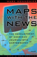
Maps with the News: The Development of American Journalistic Cartography (John D. And Catherine T. Macarthur Foundation Series On Mental Health And Development)
by Mark MonmonierMaps with the News is a lively assessment of the role of cartography in American journalism. Tracing the use of maps in American news reporting from the eighteenth century to the 1980s, Mark Monmonier explores why and how journalistic maps have achieved such importance. "A most welcome and thorough investigation of a neglected aspect of both the history of cartography and modern cartographic practice."—Mapline "A well-written, scholarly treatment of journalistic cartography. . . . It is well researched, thoroughly indexed and referenced . . . amply illustrated."—Judith A. Tyner, Imago Mundi "There is little doubt that Maps with the News should be part of the training and on the desks of all those concerned with producing maps for mass consumption, and also on the bookshelves of all journalists, graphic artists, historians of cartography, and geographic educators."—W. G. V. Balchin, Geographical Journal "A definitive work on journalistic cartography."—Virginia Chipperfield, Society of University Cartographers Bulletin
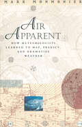
Air Apparent: How Meteorologists Learned to Map, Predict, and Dramatize Weather
by Mark MonmonierWeather maps have made our atmosphere visible, understandable, and at least moderately predictable. In Air Apparent Mark Monmonier traces debates among scientists eager to unravel the enigma of storms and global change, explains strategies for mapping the upper atmosphere and forecasting disaster, and discusses efforts to detect and control air pollution. Fascinating in its scope and detail, Air Apparent makes us take a second look at the weather map, an image that has been, and continues to be, central to our daily lives. "Clever title, rewarding book. Monmonier . . . offers here a basic course in meteorology, which he presents gracefully by means of a history of weather maps." —Scientific American "Mark Monmonier is onto a winner with Air Apparent. . . . It is good, accessible science and excellent history. . . . Read it." —Fred Pearce, New Scientist "[Air Apparent] is a superb first reading for any backyard novice of weather . . . but even the veteran forecaster or researcher will find it engaging and, in some cases, enlightening." —Joe Venuti, Bulletin of the American Meteorological Society "Monmonier is solid enough in his discussion of geographic and meteorological information to satisfy the experienced weather watcher. But even if this information were not presented in such a lively and engaging manner, it would still hook most any reader who checks the weather map every morning or who sits happily entranced through a full cycle of forecasts on the Weather Channel."—Michael Kennedy, Boston Globe
Mathematical Physics (Chicago Lectures in Physics)
by Robert GerochMathematical Physics is an introduction to such basic mathematical structures as groups, vector spaces, topological spaces, measure spaces, and Hilbert space. Geroch uses category theory to emphasize both the interrelationships among different structures and the unity of mathematics. Perhaps the most valuable feature of the book is the illuminating intuitive discussion of the "whys" of proofs and of axioms and definitions. This book, based on Geroch's University of Chicago course, will be especially helpful to those working in theoretical physics, including such areas as relativity, particle physics, and astrophysics.
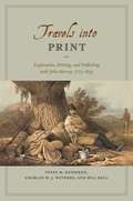
Travels into Print: Exploration, Writing, and Publishing with John Murray, 1773-1859
by Innes M. Keighren Charles W. Withers Bill BellIn eighteenth- and nineteenth-century Britain, books of travel and exploration were much more than simply the printed experiences of intrepid authors. They were works of both artistry and industry—products of the complex, and often contested, relationships between authors and editors, publishers and printers. These books captivated the reading public and played a vital role in creating new geographical truths. In an age of global wonder and of expanding empires, there was no publisher more renowned for its travel books than the House of John Murray. Drawing on detailed examination of the John Murray Archive of manuscripts, images, and the firm’s correspondence with its many authors—a list that included such illustrious explorers and scientists as Charles Darwin and Charles Lyell, and literary giants like Jane Austen, Lord Byron, and Sir Walter Scott—Travels into Print considers how journeys of exploration became published accounts and how travelers sought to demonstrate the faithfulness of their written testimony and to secure their personal credibility. This fascinating study in historical geography and book history takes modern readers on a journey into the nature of exploration, the production of authority in published travel narratives, and the creation of geographical authorship—a journey bound together by the unifying force of a world-leading publisher.
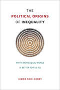
The Political Origins of Inequality: Why a More Equal World Is Better for Us All
by Simon Reid-HenryInequality is the defining issue of our time. But it is not just a problem for the rich world. It is the global 1% that now owns fully half the world’s wealth—the true measure of our age of inequality. In this historical tour de force, Simon Reid-Henry rewrites the usual story of globalization and development as a story of the management of inequality. Reaching back to the eighteenth century and around the globe, The Political Origins of Inequality foregrounds the political turning points and decisions behind the making of today’s uneven societies. As it weaves together insights from the Victorian city to the Cold War, from US economic policy to Europe’s present migration crisis, a true picture emerges of the structure of inequality itself. The problem of inequality, Reid-Henry argues, is a problem that manifests between places as well as over time. This is one reason why it cannot be resolved by the usual arguments of left versus right, bound as they are to the national scale alone. Most of all, however, it is why the level of inequality that confronts us today is indicative of a more general crisis in political thought. Modern political discourse has no place for public reason or the common good. Equality is yesterday’s dream. Yet the fact that we now accept such a world—a world that values security over freedom, special treatment over universal opportunity, and efficiency over fairness—is ultimately because we have stopped even trying in recent decades to build the political architecture the world actually requires. Our politics has fallen out of step with the world, then, and at the every moment it is needed more than ever. Yet it is within our power to address this. Doing so involves identifying and then meeting our political responsibilities to others, not just offering them the selective charity of the rich. It means looking beyond issues of economics and outside our national borders. But above all it demands of us that we reinvent the language of equality for a modern, global world: and then institute this. The world is not falling apart. Different worlds, we all can see, are colliding together. It is our capacity to act in concert that is falling apart. It is this that needs restoring most of all.
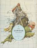
The Curious Map Book
by Ashley Baynton-WilliamsSince that ancient day when the first human drew a line connecting Point A to Point B, maps have been understood as one of the most essential tools of communication. Despite differences in language, appearance, or culture, maps are universal touchstones in human civilization. Over the centuries, maps have served many varied purposes; far from mere guides for reaching a destination, they are unique artistic forms, aides in planning commercial routes, literary devices for illuminating a story. Accuracy—or inaccuracy—of maps has been the make-or-break factor in countless military battles throughout history. They have graced the walls of homes, bringing prestige and elegance to their owners. They track the mountains, oceans, and stars of our existence. Maps help us make sense of our worlds both real and imaginary—they bring order to the seeming chaos of our surroundings. With The Curious Map Book, Ashley Baynton-Williams gathers an amazing, chronologically ordered variety of cartographic gems, mainly from the vast collection of the British Library. He has unearthed a wide array of the whimsical and fantastic, from maps of board games to political ones, maps of the Holy Land to maps of the human soul. In his illuminating introduction, Baynton-Williams also identifies and expounds upon key themes of map production, peculiar styles, and the commerce and collection of unique maps. This incredible volume offers a wealth of gorgeous illustrations for anyone who is cartographically curious.
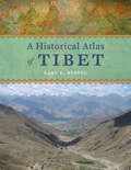
A Historical Atlas of Tibet
by Karl E. RyavecCradled among the world’s highest mountains—and sheltering one of its most devout religious communities—Tibet is, for many of us, an ultimate destination, a place that touches the heavens, a place only barely in our world, at its very end. In recent decades Western fascination with Tibet has soared, from the rise of Tibetan studies in academia to the rock concerts aimed at supporting its independence to the simple fact that most of us—far from any base camp—know exactly what a sherpa is. And yet any sustained look into Tibet as a place, any attempt to find one’s way around its high plateaus and through its deep history, will yield this surprising fact: we have barely mapped it. With this atlas, Karl E. Ryavec rights that wrong, sweeping aside the image of Tibet as Shangri-La and putting in its place a comprehensive vision of the region as it really is, a civilization in its own right. And the results are absolutely stunning. The product of twelve years of research and eight more of mapmaking, A Historical Atlas of Tibet documents cultural and religious sites across the Tibetan Plateau and its bordering regions from the Paleolithic and Neolithic times all the way up to today. It ranges through the five main periods in Tibetan history, offering introductory maps of each followed by details of western, central, and eastern regions. It beautifully visualizes the history of Tibetan Buddhism, tracing its spread throughout Asia, with thousands of temples mapped, both within Tibet and across North China and Mongolia, all the way to Beijing. There are maps of major polities and their territorial administrations, as well as of the kingdoms of Guge and Purang in western Tibet, and of Derge and Nangchen in Kham. There are town plans of Lhasa and maps that focus on history and language, on population, natural resources, and contemporary politics. Extraordinarily comprehensive and absolutely gorgeous, this overdue volume will be a cornerstone in cartography, Asian studies, Buddhist studies, and in the libraries or on the coffee tables of anyone who has ever felt the draw of the landscapes, people, and cultures of the highest place on Earth.
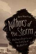
Authors of the Storm: Meteorologists and the Culture of Prediction
by Gary Alan FineWhether it is used as an icebreaker in conversation or as the subject of serious inquiry, “the weather” is one of the few subjects that everyone talks about. And though we recognize the faces that bring us the weather on television, how government meteorologists and forecasters go about their jobs is rarely scrutinized. Given recent weather-related disasters, it’s time we find out more. In Authors of the Storm, Gary Alan Fine offers an inside look at how meteorologists and forecasters predict the weather. Based on field observation and interviews at the Storm Prediction Center in Oklahoma, the National Weather Service in Washington, D.C., and a handful of midwestern outlets, Fine finds a supremely hard-working, insular clique of professionals who often refer to themselves as a “band of brothers.” In Fine’s skilled hands, we learn their lingo, how they “read” weather conditions, how forecasts are written, and, of course, how those messages are conveyed to the public. Weather forecasts, he shows, are often shaped as much by social and cultural factors inside local offices as they are by approaching cumulus clouds. By opening up this unique world to us, Authors of the Storm offers a valuable and fascinating glimpse of a crucial profession.

Demolition Means Progress: Flint, Michigan, and the Fate of the American Metropolis (Historical Studies of Urban America)
by Andrew R. HighsmithIn 1997, after General Motors shuttered a massive complex of factories in the gritty industrial city of Flint, Michigan, signs were placed around the empty facility reading, “Demolition Means Progress,” suggesting that the struggling metropolis could not move forward to greatness until the old plants met the wrecking ball. Much more than a trite corporate slogan, the phrase encapsulates the operating ethos of the nation’s metropolitan leadership from at least the 1930s to the present. Throughout, the leaders of Flint and other municipalities repeatedly tried to revitalize their communities by demolishing outdated and inefficient structures and institutions and overseeing numerous urban renewal campaigns—many of which yielded only more impoverished and more divided metropolises. After decades of these efforts, the dawn of the twenty-first century found Flint one of the most racially segregated and economically polarized metropolitan areas in the nation. In one of the most comprehensive works yet written on the history of inequality and metropolitan development in modern America, Andrew R. Highsmith uses the case of Flint to explain how the perennial quest for urban renewal—even more than white flight, corporate abandonment, and other forces—contributed to mass suburbanization, racial and economic division, deindustrialization, and political fragmentation. Challenging much of the conventional wisdom about structural inequality and the roots of the nation’s “urban crisis,” Demolition Means Progress shows in vivid detail how public policies and programs designed to revitalize the Flint area ultimately led to the hardening of social divisions.