- Table View
- List View
Reeds Marine Distance Tables 16th edition
by Miranda Delmar-MorganReeds Marine Distance Tables are the perfect ready-reckoner for captains, navigators and owners of merchant and cruise ships large and small wanting a quick and accurate distance reference between all the regularly used commercial ports around the world. They are also of increasing value to the superyacht fleet.The book is divided into key 'market areas', and includes a pull-out map for area identification and easy see-at-a-glance port reference. Traffic Separation Schemes are calculated into the tables whilst the distance to any port not included can easily be determined by making an approximation from the next closest port. Useful tables of major 'turning points' around the world (such as Cape Finisterre, Cape Horn and the Dover Straits), Transatlantic distances, world time zones, and time and speed conversion tables are also included.This edition has been improved and expanded. Emerging ports around the world have also been added to reflect modern trends and developments in shipping movements and expansions.Reeds Marine Distance Tables are an invaluable reference for ship owners, operators, brokers, navigators and superyacht skippers. Using this one reference, anyone can calculate the shortest or most economical distances between all the major ports in the world.'A first class reference' Nautical Magazine'Clear and simple support for anyone wanting to calculate the shortest or most economical distance between major ports' Telegraph
Reeds Marine Distance Tables 17th edition
by Miranda Delmar-MorganReeds Marine Distance Tables are the perfect ready-reckoner for captains, navigators and owners of merchant and cruise ships large and small wanting a quick and accurate distance reference between all the regularly used commercial ports around the world. They are also of increasing value to the superyacht fleet.The book is divided into key 'market areas', and includes a pull-out map for area identification and easy see-at-a-glance port reference. Traffic Separation Schemes are calculated into the tables whilst the distance to any port not included can easily be determined by making an approximation from the next closest port. Useful tables of major 'turning points' around the world (such as Cape Finisterre, Cape Horn and the Dover Straits), Transatlantic distances, world time zones, and time and speed conversion tables are also included.As well as incorporating general updates and improvements, this edition has been expanded to include distances for the Faroes, Shetlands and Orkneys. Freighter movements, cargo tonnage and cruise ship destinations have all been factored into considering details on the top ten busiest ports worldwide.Reeds Marine Distance Tables are an invaluable reference for ship owners, operators, brokers, navigators and superyacht skippers. Using this one reference, anyone can calculate the shortest or most economical distances between all the major ports in the world.'A first class reference' Nautical Magazine'Clear and simple support for anyone wanting to calculate the shortest or most economical distance between major ports' Telegraph
Reeds Marine Distance Tables 18th edition
by Miranda Delmar-Morgan Kendall CarterReeds Marine Distance Tables are the perfect ready-reckoner for captains, navigators and owners of merchant and cruise ships large and small wanting a quick and accurate distance reference between all the regularly used commercial ports around the world. They are also of increasing value to the superyacht fleet.The book is divided into key 'market areas', and includes a pull-out map for area identification and easy see-at-a-glance port reference. Traffic Separation Schemes are calculated into the tables whilst the distance to any port not included can easily be determined by making an approximation from the next closest port. Useful tables of major 'turning points' around the world (such as Cape Finisterre, Cape Horn and the Dover Straits), Transatlantic distances, world time zones, and time and speed conversion tables are also included.As well as incorporating general updates and improvements, this edition has been expanded to include more Indian Ocean ports, routes reflecting the increasing role of China in international shipping, as well as inter-distance tables for the Adriatic and Aegean. Freighter movements, cargo tonnage and cruise ship destinations have all been factored into considering details on the top ten busiest ports worldwide.Reeds Marine Distance Tables are an invaluable reference for ship owners, operators, brokers, navigators and superyacht skippers. Using this one reference, anyone can calculate the shortest or most economical distances between all the major ports in the world.
Reeds Maritime Flag Handbook
by Miranda Delmar-MorganThe use of flags afloat and in most maritime situations is of interest and relevance to anyone going to sea whether for commerce or pleasure. This handy pocket-sized guide is the perfect on-board reference to the maritime flags of the world and their usage. It includes: national maritime flags special ensigns yacht club burgees signal flags and flag etiquette and usage. Anyone who has ever put to sea wondering about the different typesof flag, how they are made up and the dos and don'ts as well astraditions and myths of flying flags should find this a fascinating and useful handbook.
Reeds Nautical Almanac 2020 (Reed's Almanac)
by Perrin Towler Mark FishwickReeds Nautical Almanac is the indispensable trusted annual compendium of navigational data for yachtsmen and motorboaters, and provides all the information required to navigate Atlantic coastal waters around the whole of the UK, Ireland, Channel Islands and the entire European coastline from the tip of Denmark right down to Gibraltar, Northern Morocco, the Azores and Madeira.The 2020 edition continues the Almanac's tradition of year on year improvement and meticulous presentation of all the data required for safe navigation. Now with an improved layout for easier reference and with over 45,000 annual changes, it is regarded as the bible of almanacs for anyone going to sea.The 2020 edition is updated throughout, containing over 45,000 changes, and includes: 700 harbour chartlets; tide tables and tidal streams; buoyage and lights; 7,500 waypoints; invaluable passage notes; distance tables; radio, weather and safety information; first aid section. Also: a free Marina Guide.Also available: free supplements of up-to-date navigation changes from January to June at: www.reedsnauticalalmanac.co.uk
Reeds Nautical Almanac 2021 (Reed's Almanac)
by Perrin Towler Mark FishwickReeds Nautical Almanac is the indispensable trusted annual compendium of navigational data for yachtsmen and motorboaters, and provides all the information required to navigate Atlantic coastal waters around the whole of the UK, Ireland, Channel Islands and the entire European coastline from the tip of Denmark right down to Gibraltar, Northern Morocco, the Azores and Madeira.The 2021 edition continues the Almanac's tradition of year on year improvement and meticulous presentation of all the data required for safe navigation. Now with an improved layout for easier reference and with over 45,000 annual changes, it is regarded as the bible of almanacs for anyone going to sea.The 2021 edition is updated throughout, containing over 45,000 changes, and includes: 700 harbour chartlets; tide tables and tidal streams; buoyage and lights; 7,500 waypoints; invaluable passage notes; distance tables; radio, weather and safety information; first aid section. Also: a free Marina Guide.Also available: free supplements of up-to-date navigation changes from January to June at: www.reedsnauticalalmanac.co.uk
Reeds Nautical Almanac 2022 (Reed's Almanac)
by Bloomsbury PublishingReeds Nautical Almanac is the indispensable trusted annual compendium of navigational data for yachtsmen and motorboaters, and provides all the information required to navigate Atlantic coastal waters around the whole of the UK, Ireland, Channel Islands and the entire European coastline from the tip of Denmark right down to Gibraltar, Northern Morocco, the Azores and Madeira.The 2022 edition continues the Almanac's tradition of year on year improvement and meticulous presentation of all the data required for safe navigation. Now with an improved layout for easier reference and with over 45,000 annual changes, it is regarded as the bible of almanacs for anyone going to sea.The 2022 edition is updated throughout, containing over 45,000 changes, and includes: 700 harbour chartlets; tide tables and tidal streams; buoyage and lights; 7,500 waypoints; invaluable passage notes; distance tables; radio, weather and safety information; first aid section. Also: a free Marina Guide.Also available: free supplements of up-to-date navigation changes from January to June at: www.reedsnauticalalmanac.co.uk
Reeds Nautical Almanac 2023 (Reed's Almanac)
by Perrin Towler Mark FishwickReeds Nautical Almanac is the indispensable trusted annual compendium of navigational data for yachtsmen and motorboaters, and provides all the information required to navigate Atlantic coastal waters around the whole of the UK, Ireland, Channel Islands and the entire European coastline from the tip of Denmark right down to Gibraltar, Northern Morocco, the Azores and Madeira.Having celebrated its 90th anniversary edition last year, the 2023 Almanac continues the tradition of year on year improvement and meticulous presentation of all the data required for safe navigation. Now with an improved layout for easier reference and with over 45,000 annual changes, it is regarded as the bible of almanacs for anyone going to sea.The 2023 edition is updated throughout, containing over 45,000 changes, and includes: 700 harbour chartlets; tide tables and tidal streams; buoyage and lights; 7,500 waypoints; invaluable passage notes; distance tables; radio, weather and safety information; first aid section. Also: a free Marina Guide.Also available: free supplements of up-to-date navigation changes from January to June at: www.reedsnauticalalmanac.co.uk
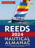
Reeds Nautical Almanac 2024 (Reed's Almanac)
by Perrin Towler Mark FishwickReeds Nautical Almanac is the indispensable trusted annual compendium of navigational data for yachtsmen and motorboaters. Known as the Yachtsman's Bible, Reeds provides all the information required to navigate Atlantic coastal waters around the whole of the UK, Ireland, Channel Islands and the entire European coastline from the tip of Denmark right down to Gibraltar, Northern Morocco, the Azores and Madeira.Having celebrated its 90th anniversary last year, the 2024 Almanac continues the tradition of year on year improvement and meticulous presentation of all the data required for safe navigation. Now with an improved layout for easier reference and with over 45,000 annual changes, it is regarded as the bible of almanacs for anyone going to sea.The 2024 edition is updated throughout and includes: 700 harbour chartlets; tide tables and tidal streams; buoyage and lights; 7,500 waypoints; invaluable passage notes; distance tables; radio, weather and safety information; first aid section. Also: a free Marina Guide.Also available: free supplements of up-to-date navigation changes from January to June at: www.reedsnauticalalmanac.co.uk
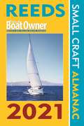
Reeds PBO Small Craft Almanac 2021 (Reed's Almanac)
by Perrin Towler Mark FishwickThe Reeds PBO Small Craft Almanac may be more compact and concise than the Reeds Nautical Almanac but it contains a wealth of indispensable navigational data specially tailored for small craft sailors, presented in an easy to find, quick reference manner for on-board use. Streamlined to focus on tidal data (tide tables, tidal streams and tidal curves) and lights, buoys and waypoints, the Small Craft Almanac covers the whole of the UK and Ireland and the west coast of Europe from Denmark to the Gironde.Published in association with Practical Boat Owner magazine, this practical handy Almanac boasts many unique features for small craft sailors and represents excellent value for money for those who don't need the more comprehensive marina data, passage information and chartlets of the full Reeds Almanac.Meticulously researched, it includes a huge amount of information of value to small craft navigators: tide tables, tidal streams and tidal gates; secondary port differences; 2,500+ waypoints; radio data; light recognition; weather information; principal lights; IALA buoyage; international codes and flags; sun/moon rise/set times; emergency information.Also available: free supplements of up-to-date navigation changes from January to June at: www.reedsnauticalalmanac.co.uk
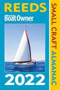
Reeds PBO Small Craft Almanac 2022 (Reed's Almanac)
by Bloomsbury PublishingThe Reeds PBO Small Craft Almanac may be more compact and concise than the Reeds Nautical Almanac but it contains a wealth of indispensable navigational data specially tailored for small craft sailors, presented in an easy to find, quick reference manner for on-board use. Streamlined to focus on tidal data (tide tables, tidal streams and tidal curves) and lights, buoys and waypoints, the Small Craft Almanac covers the whole of the UK and Ireland and the west coast of Europe from Denmark to the Gironde.Published in association with Practical Boat Owner magazine, this practical handy Almanac boasts many unique features for small craft sailors and represents excellent value for money for those who don't need the more comprehensive marina data, passage information and chartlets of the full Reeds Almanac.Meticulously researched, it includes a huge amount of information of value to small craft navigators: tide tables, tidal streams and tidal gates; secondary port differences; 2,500+ waypoints; radio data; light recognition; weather information; principal lights; IALA buoyage; international codes and flags; sun/moon rise/set times; emergency information.Also available: free supplements of up-to-date navigation changes from January to June at: www.reedsnauticalalmanac.co.uk
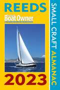
Reeds PBO Small Craft Almanac 2023 (Reed's Almanac)
by Perrin Towler Mark FishwickIn a practical handy format the Reeds PBO Small Craft Almanac, published in association with Practical Boat Owner, covers the North Atlantic coastline from Denmark to the Gironde.The Reeds PBO Small Craft Almanac may be more compact and concise than the Reeds Nautical Almanac but it contains a wealth of indispensable navigational data specially tailored for small craft sailors, presented in an easy to find, quick reference manner for on-board use. Streamlined to focus on tidal data (tide tables, tidal streams and tidal curves) and lights, buoys and waypoints, the Small Craft Almanac covers the whole of the UK and Ireland and the west coast of Europe from Denmark to the Gironde.Published in association with Practical Boat Owner magazine, this practical handy Almanac boasts many unique features for small craft sailors and represents excellent value for money for those who don't need the more comprehensive marina data, passage information and chartlets of the full Reeds Almanac.Meticulously researched, it includes a huge amount of information of value to small craft navigators: tide tables, tidal streams and tidal gates; secondary port differences; 2,500+ waypoints; radio data; light recognition; weather information; principal lights; IALA buoyage; international codes and flags; sun/moon rise/set times; emergency information.Also available: free supplements of up-to-date navigation changes from January to June at: www.reedsnauticalalmanac.co.uk
Reeds PBO Small Craft Almanac 2024 (Reed's Almanac)
by Perrin Towler Mark FishwickIn a practical handy format the Reeds PBO Small Craft Almanac, published in association with Practical Boat Owner, covers all of the UK and Ireland, as well as the North Atlantic coastline from Denmark to the Gironde.The Reeds PBO Small Craft Almanac may be more compact and concise than the Reeds Nautical Almanac but it contains a wealth of indispensable navigational data specially tailored for small craft sailors, presented in an easy-to-find, quick-reference manner for on-board use. Streamlined to focus on tidal data (tide tables, tidal streams and tidal curves) and lights, buoys and waypoints, the Small Craft Almanac covers the whole of the UK and Ireland and the west coast of Europe from Denmark to the Gironde.Published in association with Practical Boat Owner magazine, this practical handy Almanac boasts many unique features for small craft sailors and represents excellent value for money for those who don't need the more comprehensive marina data, passage information and chartlets of the full Reeds Almanac.Meticulously researched, it includes a huge amount of information of value to small craft navigators: tide tables, tidal streams and tidal gates; secondary port differences; 2,500+ waypoints; radio data; light recognition; weather information; principal lights; IALA buoyage; international codes and flags; sun/moon rise/set times; emergency information.Also available: free supplements of up-to-date navigation changes from January to June at: www.reedsnauticalalmanac.co.uk
Reeds Weather Handbook: For Sail And Power
by Frank SingletonWeather determines when we sail, where we sail to – and whether we arrive safely. This essential pocket-sized guide equips the reader with all the necessary tools to predict and deal with local and distant weather conditions, whether on a day trip or a longer cruise, along the coast or further offshore.Each topic is broken down into digestible chapters, explaining the origins and effects of the full spectrum of weather conditions, including:- using and evaluating weather forecasts- depressions, fronts, isobars and other coastal effects- waves and swell- weather lore and sky watching. Meteorology is still advancing and sources of forecasts are changing. This new edition keeps the handbook up-to-date, with a particular focus on the increasing use of GRIB files, computer weather modelling and sources of forecasts, especially with the proliferation of computer forecasts becoming available free of charge.With practical explanations and helpful diagrams and photographs, this is the ideal aide-memoire for skippers and crew, especially those studying for their Day Skipper and Yachtmaster exams.
Reeds Weather Handbook
by Frank SingletonWeather determines when we sail, where we sail to – and whether we arrive safely. This essential pocket-sized guide equips the reader with all the necessary tools to predict and deal with local and distant weather conditions, whether on a day trip or a longer cruise, along the coast or further offshore.Each topic is broken down into digestible chapters, explaining the origins and effects of the full spectrum of weather conditions, including:- using and evaluating weather forecasts- depressions, fronts, isobars and other coastal effects- waves and swell- weather lore and sky watching. Meteorology is still advancing and sources of forecasts are changing. This new edition keeps the handbook up-to-date, with a particular focus on the increasing use of GRIB files, computer weather modelling and sources of forecasts, especially with the proliferation of computer forecasts becoming available free of charge.With practical explanations and helpful diagrams and photographs, this is the ideal aide-memoire for skippers and crew, especially those studying for their Day Skipper and Yachtmaster exams.
Reeds Western Almanac 2020 (Reed's Almanac)
by Perrin Towler Mark FishwickThe Reeds Western Almanac covers the coastline from Cape Wrath to Padstow as well as the whole of Ireland, and is ideal for any boater lucky enough to cruise and race in the superb waters off the coast of Western Scotland, Ireland or Western England. It offers ready access to essential navigation information by virtue of its clear layout and user friendly format.Completely updated for 2020, topics include seamanship, pilotage, tide tables, safety procedures, navigation tips, radio, lights, waypoints, weather forecast information, communications, Mayday and distress procedures. The spiral binding allows the Almanac to be opened flat on the chart table and the large type size and clear layout makes information easy to read even in adverse conditions. It is the complete guide for both Irish and Scottish mariners as well as those cruising the UK west coast.Includes a free Reeds Marina Guide.Also available: free supplements of up-to-date navigation changes from January to June at: www.reedsnauticalalmanac.co.uk'There are some things I would not go to sea without - Reeds is one of them.'Sir Chay Blyth
Reeds Western Almanac 2021 (Reed's Almanac)
by Perrin Towler Mark FishwickThe Reeds Western Almanac covers the coastline from Cape Wrath to Padstow as well as the whole of Ireland, and is ideal for any boater lucky enough to cruise and race in the superb waters off the coast of Western Scotland, Ireland or Western England. It offers ready access to essential navigation information by virtue of its clear layout and user friendly format.Completely updated for 2021, topics include seamanship, pilotage, tide tables, safety procedures, navigation tips, radio, lights, waypoints, weather forecast information, communications, Mayday and distress procedures. The spiral binding allows the Almanac to be opened flat on the chart table and the large type size and clear layout makes information easy to read even in adverse conditions. It is the complete guide for both Irish and Scottish mariners as well as those cruising the UK west coast.Includes a free Reeds Marina Guide.Also available: free supplements of up-to-date navigation changes from January to June at: www.reedsnauticalalmanac.co.uk'There are some things I would not go to sea without - Reeds is one of them.'Sir Chay Blyth
Reeds Western Almanac 2022 (Reed's Almanac)
by Bloomsbury PublishingThe Reeds Western Almanac covers the coastline from Cape Wrath to Padstow as well as the whole of Ireland, and is ideal for any boater lucky enough to cruise and race in the superb waters off the coast of Western Scotland, Ireland or Western England. It offers ready access to essential navigation information by virtue of its clear layout and user friendly format.Completely updated for 2022, topics include seamanship, pilotage, tide tables, safety procedures, navigation tips, radio, lights, waypoints, weather forecast information, communications, Mayday and distress procedures. The large type size and clear layout makes information easy to read even in adverse conditions. It is the complete guide for both Irish and Scottish mariners as well as those cruising the UK west coast.Includes a free Reeds Marina Guide.Also available: free supplements of up-to-date navigation changes from January to June at: www.reedsnauticalalmanac.co.uk'There are some things I would not go to sea without - Reeds is one of them.'Sir Chay Blyth
Reeds Western Almanac 2023 (Reed's Almanac)
by Perrin Towler Mark FishwickThe Reeds Western Almanac covers the coastline from Cape Wrath to Padstow as well as the whole of Ireland, and is ideal for any boater lucky enough to cruise and race in the superb waters off the coast of Wales, Western Scotland, Ireland or Western England. Completely updated for 2023, it offers ready access to essential navigation information by virtue of its clear layout and user friendly format. Topics include seamanship, pilotage, tide tables, safety procedures, navigation tips, radio, lights, waypoints, weather forecast information, communications, Mayday and distress procedures. The large type size and clear layout makes information easy to read even in adverse conditions. It is the complete guide for both Irish and Welsh mariners as well as those cruising the UK west coast.Includes a free Reeds Marina Guide.Also available: free supplements of up-to-date navigation changes from January to June at: www.reedsnauticalalmanac.co.uk'There are some things I would not go to sea without - Reeds is one of them.'Sir Chay Blyth
Reeds Western Almanac 2024 (Reed's Almanac)
by Perrin Towler Mark FishwickThe Reeds Western Almanac covers the coastline from Cape Wrath to Padstow as well as the whole of Ireland, and is ideal for any boater lucky enough to cruise and race in the superb waters off the coast of Wales, Western Scotland, Ireland or Western England. Completely updated for 2024, it offers ready access to essential navigation information by virtue of its clear layout and user friendly format. Topics include seamanship, pilotage, tide tables, safety procedures, navigation tips, radio, lights, waypoints, weather forecast information, communications, Mayday and distress procedures. The large type size and clear layout, including full colour harbour plans and diagrams throughout, makes information easy to read even in adverse conditions. It is the complete guide for both Irish and Welsh mariners as well as those cruising the UK west coast.Includes a free Reeds Marina Guide.Also available: free supplements of up-to-date navigation changes from January to June at: www.reedsnauticalalmanac.co.uk'There are some things I would not go to sea without - Reeds is one of them.'Sir Chay Blyth
Reference and Anaphoric Relations (Studies in Linguistics and Philosophy #72)
by H. K. Von Heusinger U. EgliThis book is a collection of original research articles on the representation and in terpretation of indefinite and definite noun phrases, anaphoric pronouns, and closely related issues such as reference, scope and quantifier movement. A variety of frame works for the formal analysis of discourse semantics are represented, including dis course representation theory, file change semantics, dynamic Logic, E-type theories, and choice function approaches, which was one of the main issues the Konstanz project were concerned with. All of these frameworks are couched in the tradition of Montague Grammar, even though they extend the classical formalism in different directions. The developments emerged from the modern discussion of problems for the representation of cross-sentential anaphoric relations involving pronouns, and the interpretation of definite and indefinite noun phrases. After a decade of controversy, these approaches are merging together, enriching each other's formal mechanisms rather than expressing opposition. Thus, the articles in this volume concentrate on fundamental semantic questions, and also extend the current formalisms in order to capture more data. The roots of this book lie in the workshop "Reference and Anaphoric Relations", which was held at the University of Konstanz in June 1996. Five main issues were discussed: (i) the Stoic and scholastic treatment of reference and anaphora; (ii) quan tification and scope, (iii) anaphoric reference; (iv) the representation of indefinite NPs with choice functions; and (v) the relation between linguistic expressions, their rep resentations and their meanings.
Reference and Information Services: An Introduction (Library and Information Science Text Series)
by Richard E. Bopp Linda C. SmithReflecting the dramatic changes shaped by rapidly developing technologies over the past six years, this new fourth edition of Reference and Information Services takes the introduction to reference sources and services significantly beyond the content of the first three editions. In Part I, Concepts and Processes, chapters have been revised and updated to reflect new ideas and methods in the provision of reference service in an era when many users have access to the Web. In Part II, Information Sources and Their Use, discussion of each source type has been updated to encompass key resources in print and on the Web, where an increasing number of freely available sources join those purchased or licensed by libraries.A number of new authors are contributors to this new edition, bringing to their chapters their experience as teachers of reference and as practitioners in different types of libraries. Discussions of services in Part I integrate digital reference as appropriate to each topic, such as how to conduct a reference interview online using instant messaging. Boxes interspersed in the text are used to present scenarios for discussion, to highlight key concepts, or to present excerpts from important documents. Discussions of sources in Part II place more emphasis on designing effective search strategies using both print and digital resources. The chapter on selection and evaluation of sources addresses the changing nature of reference collections and how to evaluate new types of sources. Each chapter concludes with an updated list of additional readings to guide further study.A new companion website will provide links to Web-accessible readings and resources as well as additional scenarios for discussion and example search strategies to supplement those presented in the text.
Reference and Information Services: An Introduction (Library and Information Science Text Series)
by Melissa A. Wong Laura SaundersThis revised and updated sixth edition of Reference and Information Services continues the book's rich tradition, covering all phases of reference and information services with less emphasis on print and more emphasis on strategies and scenarios.Reference and Information Services is the go-to textbook for MSLIS and i-School courses on reference services and related topics. It is also a helpful handbook for practitioners. Authors include LIS faculty and professionals who have relevant degrees in their areas and who have published extensively on their topics. The first half of the book provides an overview of reference services and techniques for service provision, including the reference interview, ethics, instruction, reader's advisory, and services to diverse populations including children. This part of the book establishes a foundation of knowledge on reference service and frames each topic with ethical and social justice perspectives. The second part of the book offers an overview of the information life cycle and dissemination of information, followed by an in-depth examination of information sources by type—including dictionaries, encyclopedias, indexes, and abstracts—as well as by broad subject areas including government, statistics and data, health, and legal information. This second section introduces the tools and resources that reference professionals use to provide the services described in the first half of the text.
Reference and Information Services: An Introduction (Library and Information Science Text Series)
This revised and updated sixth edition of Reference and Information Services continues the book's rich tradition, covering all phases of reference and information services with less emphasis on print and more emphasis on strategies and scenarios.Reference and Information Services is the go-to textbook for MSLIS and i-School courses on reference services and related topics. It is also a helpful handbook for practitioners. Authors include LIS faculty and professionals who have relevant degrees in their areas and who have published extensively on their topics. The first half of the book provides an overview of reference services and techniques for service provision, including the reference interview, ethics, instruction, reader's advisory, and services to diverse populations including children. This part of the book establishes a foundation of knowledge on reference service and frames each topic with ethical and social justice perspectives. The second part of the book offers an overview of the information life cycle and dissemination of information, followed by an in-depth examination of information sources by type—including dictionaries, encyclopedias, indexes, and abstracts—as well as by broad subject areas including government, statistics and data, health, and legal information. This second section introduces the tools and resources that reference professionals use to provide the services described in the first half of the text.
Reference Guide to Famous Engineering Landmarks of the World: Bridges, Tunnels, Dams, Roads and Other Structures
by Lawrence BerlowMore than 650 landmarks are covered, ranging from ancient monuments such as Stonehenge, to contemporary engineering feats such as the World Trade Center in New York City. The concisely-written entries describe when the landmark was built, who built it, why it was built, its dimensions, how it was constructed, and any problems encountered during construction. Additional features include: numerous photographs; biographies of important builders and designers; glossary; chronology of dates in civil engineering from 3000 BC to the present; listings of tallest buildings, longest bridges, and highest dams, and a geographical index which locates the structures by country.