- Table View
- List View

World Map (Large Print)
by RnibThis is a map of the world. The map is framed by a dashed image border. There is a locator dot shown, which will be at the top left of the page when the image is the right way up. All land masses are textured (green) and sea areas are untextured (blue). On the left of the page are North and South America, in the centre Europe and Africa and to the right Asia and Australasia. Some areas have been given two-letter alphabetic labels due to space considerations. These are described in a key at the bottom left of the page.
World Map Showing Main Tectonic Plates (tactile)
by RnibThis is a tactile diagram for GCSE level students. It consists of three pages: The first page is a key with tactile symbols and labels explained, the second and third pages show a world map, with outlines of the main tectonic plates. Labels and arrows help the reader to navigate the image.
World map showing Tectonic Plates (contracted)
by RnibThis is a 2 page document containing a Key to the World Map of tectonic plates and a Map of the World showing the tectonic plates. Page One: Keys to world map of tectonic plates: This page has two keys to the world map of tectonic plates. The one on the left shows the two-letter abbreviations used on the map. The one on the right shows symbols, lines and textures (colour) with descriptive labels to the right. There is a locator dot shown, which will be at the top left of the page when the image is the right way up. Page Two: World map of tectonic plates: This is a map of the tectonic plates on the surface of the earth. There is a locator dot shown, which will be at the top left of the page when the image is the right way up. The map is framed by a dashed image border. All land masses are textured and sea areas are untextured. On the left of the page are North and South America, in the centre Europe and Africa and to the right Asia and Australasia. The boundaries of the tectonic plates are marked with a heavy line and their direction of movement indicated by arrows. Each plate is identified by a two-letter abbreviation defined in the preceding key.
World map showing Tectonic Plates (large print)
by RnibThis is a 2 page document containing a Key to the World Map of tectonic plates and a Map of the World showing the tectonic plates. Page One: Keys to world map of tectonic plates: This page has two keys to the world map of tectonic plates. The one on the left shows the two-letter abbreviations used on the map. The one on the right shows symbols, lines and textures (colour) with descriptive labels to the right. There is a locator dot shown, which will be at the top left of the page when the image is the right way up. Page Two: World map of tectonic plates: This is a map of the tectonic plates on the surface of the earth. There is a locator dot shown, which will be at the top left of the page when the image is the right way up. The map is framed by a dashed image border. All land masses are textured and sea areas are untextured. On the left of the page are North and South America, in the centre Europe and Africa and to the right Asia and Australasia. The boundaries of the tectonic plates are marked with a heavy line and their direction of movement indicated by arrows. Each plate is identified by a two-letter abbreviation defined in the preceding key.
World map showing Tectonic Plates (uncontracted)
by RnibThis is a 2 page document containing a Key to the World Map of tectonic plates and a Map of the World showing the tectonic plates. Page One: Keys to world map of tectonic plates: This page has two keys to the world map of tectonic plates. The one on the left shows the two-letter abbreviations used on the map. The one on the right shows symbols, lines and textures (colour) with descriptive labels to the right. There is a locator dot shown, which will be at the top left of the page when the image is the right way up. Page Two: World map of tectonic plates: This is a map of the tectonic plates on the surface of the earth. There is a locator dot shown, which will be at the top left of the page when the image is the right way up. The map is framed by a dashed image border. All land masses are textured and sea areas are untextured. On the left of the page are North and South America, in the centre Europe and Africa and to the right Asia and Australasia. The boundaries of the tectonic plates are marked with a heavy line and their direction of movement indicated by arrows. Each plate is identified by a two-letter abbreviation defined in the preceding key.
World Map Showing the Population Distribution (large print)
by RnibThis is a map of the World showing population distribution. A dashed line image border surrounds the diagram. There is a locator dot shown, which will be at the top left of the page when the image is the correct way up. North is at the top of the map. Population distribution is represented by solid dots (red on the Large Print version); there are more dots where there are more people.
World Map Showing the Population Distribution (UEB contracted)
by RnibThis is a map of the World showing population distribution. A dashed line image border surrounds the diagram. There is a locator dot shown, which will be at the top left of the page when the image is the correct way up. North is at the top of the map. Population distribution is represented by solid dots (red on the Large Print version); there are more dots where there are more people.
World Map Showing the Population Distribution (UEB uncontracted)
by RnibThis is a map of the World showing population distribution. A dashed line image border surrounds the diagram. There is a locator dot shown, which will be at the top left of the page when the image is the correct way up. North is at the top of the map. Population distribution is represented by solid dots (red on the Large Print version); there are more dots where there are more people.
World Maps of Climatology / Weltkarten zur Klimakunde
by H. E. LandbergAls im ersten Band des Welt-Seuchen-Atlas vor erst einmal in übersichtskarten auf die geoökologischen 10 Jahren einige Klimakarten über Temperaturverhält Probleme aufmerksam zu machen. nisse und Niederschläge in Europa erschienen, wurde von Die Herausgeber möchten mit den in dieser Ausgabe einigen Kritikern nicht verstanden, warum einem Atlas vorgelegten Weltkarten zur Klimakunde denjenigen Wis über die Verbreitung von Seuchen Karten mit klimatolo senschaftlern, die den Welt-Seuchen-Atlas benutzen, die gischen Angaben beigegeben wurden. Offensichtlich schien Möglichkeit einer Ergänzung der darin befindlichen der Gewinn an Korrelationen zu gering, die aus den An Klimakarten für Untersuchung weiterer Korrelationen gaben über klimatische Verhältnisse zu dem Auftreten geben, aber auch allen biologisch und klimatologisch von Seuchen in den gleichen Gebieten gezogen werden interessierten Fachkreisen ein Hilfsmittel für weitere konnten. Im zweiten Band wurde die Reihe der Klima geoökologische Forschungen zur Verfügung stellen. karten für den afrikanischen Kontinent durch karto Die bisher veröffentlichten Klimakarten, die für die graphische Darstellungen der Regenzeiten und der Trok ersten 3 Bände des Welt-Seuchen-Atlas von Professor Dr.
World maps of volcanoes and earthquakes (large print)
by RnibThese pages show a map of the World showing the Volcanoes and Earthquakes with an accompanying key. It is a multi-page image set on three pages. Page 1: Keys to world maps of volcanoes and earthquakes. This page has two keys: the one on the left is the key to the world map of volcanoes; the one on the right is the key to the world map of earthquakes. Both keys show two-letter abbreviations for the continents. Down from these are examples of the symbols and textures used. There is a locator dot shown, which will be at the top left of the page when the image is the right way up. Page 2: World map of volcanoes This is a map of the volcanoes on the surface of the earth framed by a dashed line image border. There is a locator dot shown, which will be at the top left of the page when the image is the right way up. All landmasses are textured and sea areas are untextured. On the left of the page are North and South America, in the centre Europe and Africa and to the right Asia and Australasia. Small volcanoes are marked by dots and large ones by small triangles. These are shown on Keys to world maps of volcanoes and earthquakes. Page 3: World map of earthquakes This is a map showing where earthquakes have occurred on the surface of the earth. It is framed by a dashed line image border. There is a locator dot shown, which will be at the top left of the page when the image is the right way up. All landmasses are textured and sea areas are untextured. On the left of the page are North and South America, in the centre Europe and Africa and to the right Asia and Australasia. Small earthquakes are marked by small dots and larger ones by larger dots. These are shown on Keys to world maps of volcanoes and earthquakes
World maps of volcanoes and earthquakes (UEB contracted)
by RnibThese pages show a map of the World showing the Volcanoes and Earthquakes with an accompanying key. It is a multi-page image set on three pages. Page 1: Keys to world maps of volcanoes and earthquakes. This page has two keys: the one on the left is the key to the world map of volcanoes; the one on the right is the key to the world map of earthquakes. Both keys show two-letter abbreviations for the continents. Down from these are examples of the symbols and textures used. There is a locator dot shown, which will be at the top left of the page when the image is the right way up. Page 2: World map of volcanoes This is a map of the volcanoes on the surface of the earth framed by a dashed line image border. There is a locator dot shown, which will be at the top left of the page when the image is the right way up. All landmasses are textured and sea areas are untextured. On the left of the page are North and South America, in the centre Europe and Africa and to the right Asia and Australasia. Small volcanoes are marked by dots and large ones by small triangles. These are shown on Keys to world maps of volcanoes and earthquakes. Page 3: World map of earthquakes This is a map showing where earthquakes have occurred on the surface of the earth. It is framed by a dashed line image border. There is a locator dot shown, which will be at the top left of the page when the image is the right way up. All landmasses are textured and sea areas are untextured. On the left of the page are North and South America, in the centre Europe and Africa and to the right Asia and Australasia. Small earthquakes are marked by small dots and larger ones by larger dots. These are shown on Keys to world maps of volcanoes and earthquakes
World maps of volcanoes and earthquakes (UEB uncontracted)
by RnibThese pages show a map of the World showing the Volcanoes and Earthquakes with an accompanying key. It is a multi-page image set on three pages. Page 1: Keys to world maps of volcanoes and earthquakes. This page has two keys: the one on the left is the key to the world map of volcanoes; the one on the right is the key to the world map of earthquakes. Both keys show two-letter abbreviations for the continents. Down from these are examples of the symbols and textures used. There is a locator dot shown, which will be at the top left of the page when the image is the right way up. Page 2: World map of volcanoes This is a map of the volcanoes on the surface of the earth framed by a dashed line image border. There is a locator dot shown, which will be at the top left of the page when the image is the right way up. All landmasses are textured and sea areas are untextured. On the left of the page are North and South America, in the centre Europe and Africa and to the right Asia and Australasia. Small volcanoes are marked by dots and large ones by small triangles. These are shown on Keys to world maps of volcanoes and earthquakes. Page 3: World map of earthquakes This is a map showing where earthquakes have occurred on the surface of the earth. It is framed by a dashed line image border. There is a locator dot shown, which will be at the top left of the page when the image is the right way up. All landmasses are textured and sea areas are untextured. On the left of the page are North and South America, in the centre Europe and Africa and to the right Asia and Australasia. Small earthquakes are marked by small dots and larger ones by larger dots. These are shown on Keys to world maps of volcanoes and earthquakes
World Metal Demand: Trends and Prospects (Routledge Revivals)
by John E. TiltonIn the early 1970s, the post-World War II boom in world metal consumption came to a halt. As time passed, it became clear that what many first thought to be a cyclical downturn was instead a long-term, substantial decline in world metal demand. In this volume, first published in 1990, editor John E. Tilton and four fellow scholars of mineral economics analyse the causes and consequences of this decline and the prospects for future growth in world metal demand. This book will be of interest to students of business and environmental studies.
World Mineral Exploration: Trends and Economic Issues (Routledge Revivals)
by John E. Tilton Roderick G. Eggert Hans H. LandsbergMineral exploration is an economic activity of worldwide importance. This volume, originally published in 1988, makes a substantial contribution to the understanding of mineral exploration and the major economic, political, and geologic forces that govern it. Some chapters examine the behaviour and performance of particular participants in the exploration process while others focus on specific countries. This is a valuable title for any student interested in environmental studies and the global impact of econonmics.
World Mineral Trends and U.S. Supply Problems (Routledge Revivals)
by Leonard L. FischmanEven though the United States relies heavily on imports for many non-fuel minerals, mineral supply has played only a small role in foreign policy since World War II. Originally published in 1980, this report investigates seven major non-fuel minerals in relation to long-term potential supply and price problems and any short-term issues that may arise to put concerns about supply in perspective for policy-makers. This title will be of interest to students of Environmental Studies and professionals.
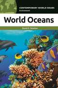
World Oceans: A Reference Handbook (Contemporary World Issues)
by David E. NewtonWorld Oceans: A Reference Handbook offers an in-depth discussion of the world's oceans. It discusses the marine life that is dependent on the sea as well as the problems threatening the health of the ocean and its wildlife.World Oceans: A Reference Handbook opens with an overview of the history of human knowledge and understanding of the oceans and cryosphere, along with related scientific, technological, social, political, and other factors. The second chapter presents and discusses about a dozen major problems facing the Earth's oceans today, along with possible solutions. The third chapter provides interested individuals with an opportunity to express their thoughts and ideas on today's ocean issues, and remaining chapters provide additional resources, such as a bibliography, a chronology, and a glossary, to assist the reader in her or his further study of the issue.Where most books for young adults learning about world oceans take a purely expository treatment, this book provides readers with additional information as well as resources, allowing them to learn more and inform further study of the subject.
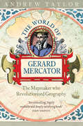
The World of Gerard Mercator: The Mapmaker Who Revolutionised Geography
by Andrew TaylorThe true story of Gerard Mercator, the greatest map-maker of all time, who was condemned to death as a heretic.
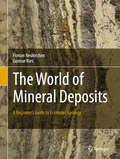
The World of Mineral Deposits: A Beginner's Guide to Economic Geology
by Florian Neukirchen Gunnar RiesThis vivid introduction to economic geology not only describes the most important deposit types, but also the processes involved in their formation. Magmatic, hydrothermal and sedimentary processes as well as weathering and alteration are explained in the framework of plate tectonics and the history of the Earth. The chapter about fossil fuels includes unconventional deposits and the much-debated fracking. Other topics covered are exploration, mining and economic aspects like commodity prices.
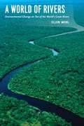
A World of Rivers: Environmental Change on Ten of the World's Great Rivers
by Ellen WohlFar from being the serene, natural streams of yore, modern rivers have been diverted, dammed, dumped in, and dried up, all in efforts to harness their power for human needs. But these rivers have also undergone environmental change. The old adage says you can’t step in the same river twice, and Ellen Wohl would agree—natural and synthetic change are so rapid on the world’s great waterways that rivers are transforming and disappearing right before our eyes. A World of Rivers explores the confluence of human and environmental change on ten of the great rivers of the world. Ranging from the Murray-Darling in Australia and the Yellow River in China to Central Europe’s Danube and the United States’ Mississippi, the book journeys down the most important rivers in all corners of the globe. Wohl shows us how pollution, such as in the Ganges and in the Ob of Siberia, has affected biodiversity in the water. But rivers are also resilient, and Wohl stresses the importance of conservation and restoration to help reverse the effects of human carelessness and hubris. What all these diverse rivers share is a critical role in shaping surrounding landscapes and biological communities, and Wohl’s book ultimately makes a strong case for the need to steward positive change in the world’s great rivers.