Special Collections
School Atlas and maps
Description: A selection of school atlas and map books, some accessible image maps. We have a large range of accessible image, large print and tactile maps at: https://www.rnibbookshare.org/cms/map-related-images
- Table View
- List View
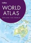
Collins World Atlas
by Collins MapsThe clear and detailed mapping in this bestselling Collins world atlas has been brought fully up-to-date to reflect all recent geopolitical changes. Great value and contains all the world maps you need in a budget atlas, for family, study and business use. FEATURES: • Fully revised, detailed reference maps of the world. • Map of the world's countries and physical features. • Introductory section includes facts on all the countries of the world, including flags, area, population, capital city, languages, religions and currency. • Map of the world’s time zones. • Over 10,000 index entries. A new, fully updated edition of this bestselling atlas of the world.
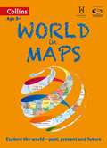
World In Maps
by Stephen ScoffhamCollins World in Maps is a multi-topic atlas of the world, which introduces the most relevant physical and human topics to reflect the Geography Key Stage 2-3 requirements of the National Curriculum. Formerly published as Collins Keystart World Atlas, this collection of maps can be used to investigate different themes and topics. It tells a story in maps, diagrams, charts, words and photographs, each of which presents information to compare and examine. We live on a remarkable planet and this atlas helps us to make sense of the world today and understand how things came to be, as well as how they might change in years to come. Suggested activities on each spread encourage users to explorer further.
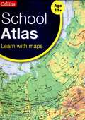
School Atlas
by Collins MapsAn introductory atlas for secondary schools, perfectly designed to support and motivate Key Stage 3 students in geographical and mapping skills. Previously published as the award winning Collins Foundation World Atlas the Collins School Atlas has been revised and extended. It features 96 pages of clear, easy to read maps, satellite images, an atlas skills section and hundreds of statistics. This introductory atlas for secondary school students aged 11-14 is designed to help students develop map, atlas and data handling skills. The content adheres closely to the requirements of the National Curriculum and incorporates results of classroom testing. Its clear and accessible layout will motivate pupils of all abilities at Key Stage 3 and S1-S2. An easy to follow introductory 'map and atlas skills' section, useful for both teacher and pupil, is followed by clear, easy to read reference maps presented with locator maps, fact boxes and flags, descriptive text, detailed map keys and photos. For this new edition more detailed reference mapping of the British Isles is included. âe¢ Carefully selected focus country studies include mapping on contrasting regions and special topics. âe¢ The latest available country-by-country statistics are listed in a separate section and the index includes full latitude and longitude values. âe¢ The extended world section in this edition covers all the global issues required by the National Curriculum e. g. climate, population, biomes, earthquakes and volcanoes. âe¢ Colour coding of the titling and marginalia aids the identification of the sections within the atlas.

Oxford Student Atlas (4th edition) (PDF)
by Patrick WiegandThis new edition of the Oxford Student Atlas includes stunning satellite images, country data, and easy-to-read colourful mapping, presented in an accessible visual layout based on research into how students use maps. The atlas covers key exam specification themes and issues such as earthquakes and volcanoes, climate and climate change, economic activity, development, and globalisation. It includes comprehensive coverage of the British Isles, Europe, and the world. It is the ideal atlas for students to use on exam courses.nbsp;
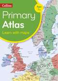
Collins Primary Atlas [Fifth edition] (PDF)
by Collins MapsProviding an introduction to mapping of all major regions of the world, this reference includes information on map reading skills, the meaning of scale and measuring distances. The reference maps are informative, politically colored, and easy to read with national capitals and major cities easily identifiable. The maps are supported with national flags and basic national statistics. Continental maps are linked to the regional mapping and are supported by a selection of aerial and terrestrial photographs. Continental relief maps show layer coloring and major physical features are highlighted. The index uses a simple grid reference system, and a selection of web addresses is included to help with further study.
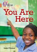
Collins Big Cat, Band 12, Copper
by Isabel Thomas and Collins Big Cat StaffEvery map tells a story and makes spaces, ideas, and events easier to understand. Where are you? Let's find out! * Copper/Band 12 books provide more complex plots and longer chapters that develop reading stamina. * Text type - An information book. * The book is organised into short chapters to help children practise the skills of locating and identifying important information. * The glossary and index on page 29 can be used to develop children's information retrieval skills further. * Curriculum links - Geography - geographical skills

World Map- basic outline (tactile)
by Sheffield Vi ServiceThis is an outline map of the world with North and South America to the left, Australia to the right and Antarctica at the bottom of the image.
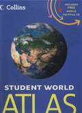
Student World Atlas
by Collins MapsCompletely new and extended edition of the best-selling Collins Student Atlas. Created specifically for Key Stage 4 students, and a vital tool for all students. Collins Student World Atlas (Fourth edition), with free World Factfile CD, has been specifically designed for students aged 14-16 years, however its well-researched uncluttered design makes it suitable for all students. This 200 page fourth edition has been extensively revised, updated and extended. It features up-to-date reference and thematic mapping, mapping skills, country-by-country statistics and a fully comprehensive index to all names appearing on reference maps. Thematic maps and accompanying graphs and tables adhere strictly to the National Curriculum guidelines and cover topics such as Tourism, Telecommunications, Environmental and socio-economic topics. All maps have been fully updated using the latest statistical information available. The inclusion of a selective list of web addresses on each thematic page ensures students are motivated to explore more deeply into a topic. High quality satellite imagery, which has been selectively used within special topic or study areas, supports data on the maps and is used to illustrate key environmental issues. Extensive lists of statistics for demographic and socio-economic facts provide up-to-date data for students wishing to create their own graphs to support individual geography, tourism, mathematics, economics or IT projects. New features • Free World Factfile on CD • Pollution hotspots in the Mediterranean Sea • Urban pollution in Italy • World Agriculture • World Urbanization • World Climate Change • Low and Middle Economic Developing Countries • Ecological footprint World factfile CD includes; • Major world themes presented through maps, graphics, statistics and images • Detailed profiles for 50 countries • Indispensable geographical facts • Authoritative statistics • Geographic overview of the world’s major regions • Packed full of geographical information, current affairs and world mapping This attractive resource provides ideal factual support material to everyone’s reference atlas.
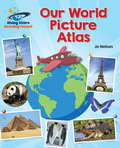
Reading Planet - Our World Picture Atlas - Orange
by Katie DaynesGalaxy reading books are a wonderful collection of fiction, non-fiction, poetry and plays to capture the interest of every child, helping to develop a life-long love of reading. Turn each page of this non-fiction title to explore some amazing places and learn lots of fascinating things about our incredible planet. Packed with maps, photos and facts, this information book provides a fantastic introduction to world geography. Reading age: 5-6 years.
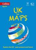
UK In Maps (PDF)
by Stephen Scoffham and Collins Maps StaffCollins UK in Maps is a multi-topic atlas of the UK, which introduces the most relevant topics to reflect the Geography Key Stage 2-3 requirements of the National Curriculum. Formerly published as Collins Keystart UK Atlas, this collection of maps can be used to investigate different themes and topics. It tells a story in maps, diagrams, charts, words and photographs each of which presents information to compare and examine. We live on a remarkable planet and this atlas helps us to make sense of the UK today and understand how things came to be as well as how they might change in years to come. Suggested activities on each spread encourage users to explorer further.
Oxford Students Atlas (PDF) (400MB+)
by Patrick Wiegand400MB+ File Request - email bookshare@rnib.org.uk to request this title by WeTransfer. This new edition of the Oxford Student Atlas includes stunning satellite images, country data, and easy-to-read colourful mapping, presented in an accessible visual layout based on research into how students use maps. The atlas covers key exam specification themes and issues such as earthquakes and volcanoes, climate and climate change, economic activity, development, and globalisation. It includes comprehensive coverage of the British Isles, Europe, and the world. It is the ideal atlas for students to use on exam courses. The Oxford Student Atlas is accompanied by an e-Atlas CD-ROM providing an interactive version of the atlas suitable for both individual study and whole-class display.
Collins School World Atlas
by Collins MapsAn introductory atlas for secondary schools, perfectly designed to support and motivate Key Stage 3 students in geographical and mapping skills. • Previously published as the award winning Collins Foundation World Atlas the Collins School Atlas has been revised and extended. It features 96 pages of clear, easy to read maps, satellite images, an atlas skills section and hundreds of statistics. • This introductory atlas for secondary school students aged 11-14 is designed to help students develop map, atlas and data handling skills. The content adheres closely to the requirements of the National Curriculum and incorporates results of classroom testing. • Its clear and accessible layout will motivate pupils of all abilities at Key Stage 3 and S1-S2. An easy to follow introductory 'map and atlas skills' section, useful for both teacher and pupil, is followed by clear, easy to read reference maps presented with locator maps, fact boxes and flags, descriptive text, detailed map keys and photos. For this new edition more detailed reference mapping of the British Isles is included. • Carefully selected focus country studies include mapping on contrasting regions and special topics. • The latest available country-by-country statistics are listed in a separate section and the index includes full latitude and longitude values. • The extended world section in this edition covers all the global issues required by the National Curriculum e.g. climate, population, biomes, earthquakes and volcanoes. • Colour coding of the titling and marginalia aids the identification of the sections within the atlas.
Collins World Atlas Reference Edition 400mb+ (PDF)
by HarperCollins Publishers400MB+ Please request by email. A new, fully updated edition of this popular atlas in the stylish and authoritative Collins world atlas range. Designed in the distinctive Collins style, it is the ideal reference atlas for school, home and business use. This is a great value world atlas with more place names (over 80,000) and mapping than any other atlas at this price. Discover more about our world, continent by continent, with this Collins World Atlas, which has been brought fully up-to-date to reflect all recent changes. The highly detailed yet clear and accessible maps give balanced worldwide coverage, and the atlas includes beautifully illustrated thematic pages. Also includes maps of the world's physical features, details of all the world's states and territories, a map of world’s time zones, internet links and thousands of facts and key world statistics, including world and continental ranking tables, to enhance your knowledge of the world today. UPDATES INCLUDE • Over 1,500 name changes Country name change from Czech Republic to Czechia (Czech Republic) • New administrative regions in France • Major revision to roads and railways in China • Revision to major city populations • Addition of Moroccan Berm (security wall) in Western Sahara • latest UNESCO World Heritage sites
Longman School Atlas (PDF)
by Stephen ScoffhamLongman School Atlas Introduces key themes of interdependence, environment, globalisation, change and development including a chapter dedicated to development issues. Earth from the sky sections provide satellite images and aerial photographs for every continent, giving pupils the opportunity to use a variety of secondary sources. A map skills section gives clear guidance on how to use the atlas.
Atlas of Oceans
by John FarndonSeventy per cent of our planet's surface is covered with water, but most conventional atlases focus on the other thirty per cent. This fascinating and beautifully presented survey of the world's oceans and what lives within them is published in association with the Census on Marine Life, a decade-long scientific initiative between researchers from over 80 countries to assessing and explaining the rich diversity and abundance of undersea life.Every aspect of the oceans is explored, from the seabed, continental shelves, currents, water circulation and waves, to all the wildlife that calls these places home. Each ocean (the Atlantic, Pacific, Indian, Southern, Arctic, the Seas of Europe, the Eurasian Inland Seas and the South China Sea) is examined in great detail, revealing its characteristics, underwater topography, principal species and particular features, including the effects of habitat erosion.Topics covered include:- Coastlines, beaches, estuaries, salt marshes - the clash of man and wildlife- Temperate waters - plankton, seaweed forests and the Newfoundland Great Banks- Tropical waters - coral reefs, mangrove swamps and seagrass meadows- Polar waters - floating ice, migrations, life beneath the ice- The open ocean - currents, CO2 storage capacity, global warming and acidification - The ocean deeps - the mysterious twilight world and the least explored of all environments
World Map (large print)
by RnibThis is a map of the world. The map is framed by a dashed image border. There is a locator dot shown, which will be at the top left of the page when the image is the right way up. All land masses are textured (green) and sea areas are untextured (blue). On the left of the page are North and South America, in the centre Europe and Africa and to the right Asia and Australasia. Some areas have been given two-letter alphabetic labels due to space considerations. These are described in a key at the bottom left of the page.
Keystart UK Atlas (PDF)
by Stephen Scoffham and Collins Maps StaffThis atlas is for 7-11 year olds. Each spread of the atlas is devoted to a single topic and the maps are supported by text, photographs, illustrations and simple graphs. It is organised into themes: skills, water and landscape, settlement, environment, citizenship and places.
World Map (Large Print)
by RnibThis is a map of the world. The map is framed by a dashed image border. There is a locator dot shown, which will be at the top left of the page when the image is the right way up. All land masses are textured (green) and sea areas are untextured (blue). On the left of the page are North and South America, in the centre Europe and Africa and to the right Asia and Australasia. Some areas have been given two-letter alphabetic labels due to space considerations. These are described in a key at the bottom left of the page.
Maps
by Sally HewittLearn about maps and how to use them through an exciting combination of information and step-by-step activities.Simple text and full-colour images make Project Geography the perfect introduction to the world around us.